1
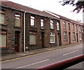
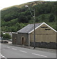
School Road, Ogmore Vale
Ascending from Prospect Place towards Highland Place.
Image: © Jaggery
Taken: 25 Aug 2018
0.01 miles
2
House on the corner of School Road and Llywelyn Street, Ogmore Vale
The car is in School Road.
Image: © Jaggery
Taken: 25 Aug 2018
0.02 miles
3
West side of Prospect Place, Ogmore Vale
Row of houses extending towards School Road.
Image: © Jaggery
Taken: 25 Aug 2018
0.02 miles
4
Postbox in a Llywelyn Street wall, Ogmore Vale
The box is from the reign of King George V. https://www.geograph.org.uk/photo/5886478
Image: © Jaggery
Taken: 25 Aug 2018
0.04 miles
5
King George V postbox in a Llywelyn Street wall, Ogmore Vale
Located here. https://www.geograph.org.uk/photo/5886477 The GR on the box is short for Georgius Rex, Latin for King George,
in this case King George V who reigned from May 1910-January 1936.
Image: © Jaggery
Taken: 25 Aug 2018
0.04 miles
6
Detached house in Ogmore Vale
On the west side of Llywelyn Street.
Image: © Jaggery
Taken: 25 Aug 2018
0.04 miles
7
Bend in Prospect Place, Ogmore Vale
Viewed from the northern end of Meadow Street.
Image: © Jaggery
Taken: 25 Aug 2018
0.04 miles
8
Junction of Sunny Bank and Llywelyn Street, Ogmore Vale
On the left, dead-end Sunny Bank diverges from Llywelyn Street.
Image: © Jaggery
Taken: 25 Aug 2018
0.05 miles
9
Llywelyn Street electricity substation, Ogmore Vale
The Sunny Bank side of the Western Power Distribution electricity substation
on the corner of Llywelyn Street. Its identifier is S/S 563694
Image: © Jaggery
Taken: 25 Aug 2018
0.05 miles
10
Tynewydd Funeral Service, Llywelyn Street, Ogmore Vale
In August 2018 FUNERAL is missing from the name on the side wall.
Image: © Jaggery
Taken: 25 Aug 2018
0.05 miles


