IMAGES TAKEN NEAR TO
Penllwyngwent Industrial Estate, Saville Road, BRIDGEND, CF32 7AX

Introduction

This page details the photographs taken nearby to Penllwyngwent Industrial Estate, Saville Road, CF32 7AX by members of the Geograph project.

The Geograph project started in 2005 with the aim of publishing, organising and preserving representative images for every square kilometre of Great Britain, Ireland and the Isle of Man.

There are currently over 7.5m images from over14,400 individuals and you can help contribute to the project by visiting https://www.geograph.org.uk

Image Map


Images are licensed for reuse under creativecommons.org/licenses/by-sa/2.0
Notes
  • Clicking on the map will re-center to the selected point.
  • The higher the marker number, the further away the image location is from the centre of the postcode.

Image Listing (50 Images Found)

Images are licensed for reuse under creativecommons.org/licenses/by-sa/2.0
  • ...
Image
Details
Distance
1
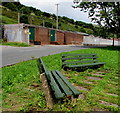
Two benches alongside North Road, Ogmore Vale
Ogmore Vale Primary electricity substation is in the background.
Image: © Jaggery Taken: 23 Aug 2018
0.10 miles
2
Penllwyngwent Industrial Estate
Entrance to the Penllwyngwent industrial estate.
Image: © Alan Hughes Taken: 18 May 2017
0.10 miles
3
Ogmore Vale Primary electricity substation
The southern edge of the large Western Power Distribution electricity substation site on the west side of North Road in Ogmore Vale.
Image: © Jaggery Taken: 23 Aug 2018
0.11 miles
4
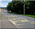
North Road bus stop, Ogmore Vale
This stop is for buses north to Nantymoel. Painted yellow letters on the road surface show BUS STOP and the Welsh SAFLE BYSIAU. In some other locations in Wales, the form SAFLE BWS is used, such as in Cwmparc http://www.geograph.org.uk/photo/4119803 in the Rhondda. Bysiau is the plural of bws.
Image: © Jaggery Taken: 23 Aug 2018
0.11 miles
5
West side of North Road, Ogmore Vale
Row of houses north of Cuthbert Street.
Image: © Jaggery Taken: 23 Aug 2018
0.11 miles
6
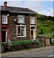
Old-style name sign, North Road, Ogmore Vale
An enamel name sign is on the wall between first-floor windows.
Image: © Jaggery Taken: 23 Aug 2018
0.11 miles
7
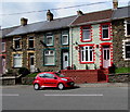
Red car and partly red house in Ogmore Vale
Viewed across North Road.
Image: © Jaggery Taken: 23 Aug 2018
0.11 miles
8
Long row of houses, North Road, Ogmore Vale
On the west side of North Road.
Image: © Jaggery Taken: 23 Aug 2018
0.12 miles
9
Row of six houses, North Road, Ogmore Vale
The middle of the row is opposite Hill Street. https://www.geograph.org.uk/photo/5881043
Image: © Jaggery Taken: 23 Aug 2018
0.12 miles
10
Ordnance Survey Cut Mark
This OS cut mark can be found on No5 North Road. It marks a point 155.485m above mean sea level.
Image: © Adrian Dust Taken: 29 May 2017
0.13 miles
  • ...