1
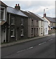
West side of Bethania Row, Ogmore Vale
Looking north along the A4061 Bethania Row towards the Corbett Street junction.
Image: © Jaggery
Taken: 23 Aug 2018
0.00 miles
2
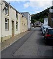
East along Corbett Street, Ogmore Vale
Towards the A4061 Bethania Row.
Image: © Jaggery
Taken: 25 Aug 2018
0.00 miles
3
Year 1876 on the tablet on the former Bethania Chapel, Ogmore Vale
The tablet on this https://www.geograph.org.uk/photo/6001177 derelict building records the erection of the chapel in 1876, a rebuild of the 1848 original.
Image: © Jaggery
Taken: 23 Aug 2018
0.01 miles
4
Ogmore Valley Silver Band hall, Bethania Row, Ogmore Vale
The hall is next door to the long derelict former Bethania chapel. https://www.geograph.org.uk/photo/6001177
Image: © Jaggery
Taken: 23 Aug 2018
0.01 miles
5
Years 1846 and 1898 on a Bethania Row hall, Ogmore Vale
The tablet on this https://www.geograph.org.uk/photo/6001198 wall records that the hall is the 1898 rebuild of the 1846 original. The text is in Welsh.
Image: © Jaggery
Taken: 23 Aug 2018
0.01 miles
6
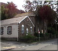
Derelict former Bethania Chapel, Bethania Row, Ogmore Vale
The building alongside the A4061 Bethania Row is the 1876 https://www.geograph.org.uk/photo/6001179 rebuild of the 1848 original chapel. The chapel closed down in the 1990s. In August 2018 some of the windows not protected by boards are broken. There is a gap in the stone perimeter wall.
Image: © Jaggery
Taken: 23 Aug 2018
0.01 miles
7
Hall and a derelict church, Bethania Row, Ogmore Vale
In August 2018 the hall https://www.geograph.org.uk/photo/6001198 is the home of Ogmore Vale Silver Band.
Derelict former Bethania chapel https://www.geograph.org.uk/photo/6001177 is on the right.
Image: © Jaggery
Taken: 23 Aug 2018
0.01 miles
8
Bethania Chapel, Ogmore Vale
With its smashed and boarded windows this derelict chapel appears disconsolate, almost in tears!
Image: © Alan Hughes
Taken: 17 Oct 2020
0.01 miles
9
Ogmore Valley Welfare Hall, Ogmore Vale
A Free car park sign is alongside Ogmore Valley Welfare Hall on the east side of the A4061 Bethania Row.
Image: © Jaggery
Taken: 23 Aug 2018
0.02 miles
10
Former police station, Bethania Row, Ogmore Vale
The inscription https://www.geograph.org.uk/photo/5882113 on the house wall shows POLICE STATION 1884.
Image: © Jaggery
Taken: 23 Aug 2018
0.02 miles


