1
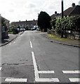
Dark green cabinets on a St Brides Major corner
Two telecoms cabinets are near a yellow grit box on the corner of the B4524 Southerndown Road and Heol-y-slough.
Image: © Jaggery
Taken: 4 Sep 2019
0.02 miles
2
Junction at the western edge of St Brides Major
The B4524 towards Southerndown is on the left.
Heol-y-slough towards Heol-y-mynydd and Norton is on the right.
Image: © Jaggery
Taken: 4 Sep 2019
0.02 miles
3
Junction of Heol-y-slough and the B4524, St Brides Major
Ahead on the B4524 Southerndown Road for the centre of St Brides Major.
Turn right for Southerndown and Ogmore-by-Sea.
Image: © Jaggery
Taken: 4 Sep 2019
0.02 miles
4
Houses alongside the B4524 in St Brides Major
The houses are opposite fields. Ahead on the B4524 for Southerndown and Ogmore-by-Sea.
Image: © Jaggery
Taken: 4 Sep 2019
0.03 miles
5
Children's playground in St Brides Major
Set back from the south side of Heol Sant Bridget, accessed from the side road on the left here. https://www.geograph.org.uk/photo/6257268
Image: © Jaggery
Taken: 4 Sep 2019
0.03 miles
6
Houses at a bend in Heol Sant Bridget, St Brides Major
The side road on the left leads to a children's playground. https://www.geograph.org.uk/photo/6257275
Image: © Jaggery
Taken: 4 Sep 2019
0.03 miles
7
Bus stand on the B4524, St Brides Major
In September 2019 this is a stop on bus route 303 from Bridgend to Barry.
A partly obliterated STOP remains visible below STAND.
I wondered if BUS STAND indicates a village version of a bus station,
but that seems unlikely as this location is at the edge of the village and
the bus on which I arrived left here immediately after I alighted.
The painted yellow text is also in Welsh.
Image: © Jaggery
Taken: 4 Sep 2019
0.04 miles
8
From 40 to 30 on the B4524, St Brides Major
The 40mph speed limit on the B4524 from Southerndown drops to
30mph at the western edge of St Brides Major in the Vale of Glamorgan.
Image: © Jaggery
Taken: 4 Sep 2019
0.04 miles
9
End of the 30 zone on the B4524 beyond St Brides Major in the Vale of Glamorgan
The speed limit increases to 40 mph. Ahead for Southerndown.
Image: © Jaggery
Taken: 4 Sep 2019
0.04 miles
10
Heol Sant Bridget, St Brides Major
The southwest end of Heol Sant Bridget viewed from Lon-yr-eglwys.
Image: © Jaggery
Taken: 4 Sep 2019
0.04 miles


