
IMAGES TAKEN NEAR TO
Coytrahen, BRIDGEND, CF32 0EB
Introduction
This page details the photographs taken nearby to CF32 0EB by members of the Geograph project.
The Geograph project started in 2005 with the aim of publishing, organising and preserving representative images for every square kilometre of Great Britain, Ireland and the Isle of Man.

There are currently over 7.5m images from over14,400 individuals and you can help contribute to the project by visiting https://www.geograph.org.uk
Image Map
Images are licensed for reuse under creativecommons.org/licenses/by-sa/2.0
Notes
- Clicking on the map will re-center to the selected point.
- The higher the marker number, the further away the image location is from the centre of the postcode.
Image Listing (47 Images Found)
Images are licensed for reuse under creativecommons.org/licenses/by-sa/2.0
Image
Details
Distance
1
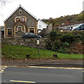
The Old Chapel, Coytrahen
Viewed across the A4063 Maesteg Road. Still showing as a place of worship on some maps,
the former Wesleyan Methodist Chapel dating from 1901 has been converted to residential use.
Image: © Jaggery
Taken: 28 Oct 2014
0.02 miles
2
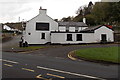
East side of the Nicholls Arms in Coytrahen
Viewed across the A4063 Maesteg Road. The pub is on the corner of Nicholls Road.
The Nicholls family of Merthyr Mawr used to be prominent landowners in the area.
http://www.geograph.org.uk/photo/4223677 to another view.
Image: © Jaggery
Taken: 28 Oct 2014
0.03 miles
3
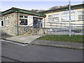
Philip Squire Community Centre, Coytrahen
Image: © Guy Butler-Madden
Taken: 22 Jan 2012
0.03 miles
4
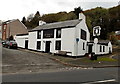
Nicholls Arms, Coytrahen
Pub on the corner of the A4063 Maesteg Road and Nicholls Road.
The Nicholls family of Merthyr Mawr used to be prominent landowners in the area.
http://www.geograph.org.uk/photo/4223679 to another view.
Image: © Jaggery
Taken: 28 Oct 2014
0.03 miles
5
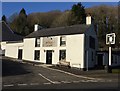
Nicholls Arms
The Nicholls Arms at Coytrahen.
Image: © Alan Hughes
Taken: 3 Jan 2017
0.03 miles
6
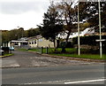
Entrance to Coytrahen Community Centre
From the A4063 Maesteg Road.
Image: © Jaggery
Taken: 28 Oct 2014
0.04 miles
7
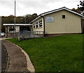
Coytrahen Community Centre
Set back 30 metres from the east side of A4063 Maesteg Road.
Coytrahen Community Centre is also known as the Phillip Squire Centre.
Image: © Jaggery
Taken: 28 Oct 2014
0.05 miles
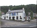
9
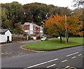
Autumn colours in Coytrahen
Viewed across the A4063 Maesteg Road in late October 2014. The two semi-detached houses are Treetops and Bethune. The white edge of the Nicholls Arms http://www.geograph.org.uk/photo/4223677 is on the left.
Image: © Jaggery
Taken: 28 Oct 2014
0.06 miles
10
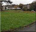
Playground near Coytrahen Community Centre
On the south side of the community centre. http://www.geograph.org.uk/photo/4224023
Image: © Jaggery
Taken: 28 Oct 2014
0.07 miles