1
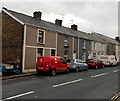
Royal Mail van in Coytrahen
Viewed across the A4063 Maesteg Road. The name sign on the left shows VICTORIA BUILDINGS.
Image: © Jaggery
Taken: 28 Oct 2014
0.01 miles
2
Coytrahen Stores & Post Office
There is a Business Lease for Sale notice on the premises in Heol Cefn Ydfa in late October 2014.
Image: © Jaggery
Taken: 28 Oct 2014
0.02 miles
3
The A 4063 at Coytrahen
Northward view along the A 4063 road as it passes through the village of Coytrahen.
Image: © eswales
Taken: 14 Jun 2008
0.03 miles
4
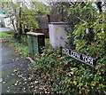
Two boxes in Heol Cefn Ydfa, Coytrahen
The green telecoms box and grey electricity substation are near the village stores and post office. http://www.geograph.org.uk/photo/4223606
Image: © Jaggery
Taken: 28 Oct 2014
0.03 miles
5
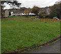
Playground near Coytrahen Community Centre
On the south side of the community centre. http://www.geograph.org.uk/photo/4224023
Image: © Jaggery
Taken: 28 Oct 2014
0.04 miles
6
Old Milestone by the A4063, Coytrah?n, Llangynwyd Lower parish
Milestone by the A4063, in parish of Llangynwyd Lower (Bridgend County Borough District), Coytrahên, centre of village, West side of road, next to bus shelter.
Inscription reads:-
: MAESTEG / 5 / MILES : : RAILWAY / STATION / 4¼ : : BRIDGEND / 4 / MILES :
Surveyed
Milestone Society National ID: GLA_MSBE05
Image: © Milestone Society
Taken: Unknown
0.04 miles
7
Towards Heol Coed Leyshon in Coytrahen
Viewed across the A4063 Maesteg Road. The road leads to houses in Heol Coed Leyshon,
Heol Treharne and Heol Coed Ydfa, which is also the location of the village post office. http://www.geograph.org.uk/photo/4223606
Image: © Jaggery
Taken: 28 Oct 2014
0.04 miles
8
Milestone - Bridgend 4
Image: © Adrian Dust
Taken: 13 Oct 2021
0.05 miles
9
Residential crossroads in Coytrahen
Viewed from Heol Coed Ydfa looking across Heol Coed Leyshon towards Heol Treharne.
Image: © Jaggery
Taken: 28 Oct 2014
0.05 miles
10
Milestone and bus shelter in Coytrahen
Viewed across the A4063 Maesteg Road. The face of the milestone in view shows MAESTEG 5.
Image: © Jaggery
Taken: 28 Oct 2014
0.05 miles


