
IMAGES TAKEN NEAR TO
Ty Fry Road, BRIDGEND, CF32 0BB
Introduction
This page details the photographs taken nearby to Ty Fry Road, CF32 0BB by members of the Geograph project.
The Geograph project started in 2005 with the aim of publishing, organising and preserving representative images for every square kilometre of Great Britain, Ireland and the Isle of Man.

There are currently over 7.5m images from over14,400 individuals and you can help contribute to the project by visiting https://www.geograph.org.uk
Image Map
Images are licensed for reuse under creativecommons.org/licenses/by-sa/2.0
Notes
- Clicking on the map will re-center to the selected point.
- The higher the marker number, the further away the image location is from the centre of the postcode.
Image Listing (36 Images Found)
Images are licensed for reuse under creativecommons.org/licenses/by-sa/2.0
Image
Details
Distance
1

Mountain View Garage, Cefn Cribwr
Located on the east side of Ty Fry Road, Mountain View Garage is the premises of GM Coaches Ltd.
Image: © Jaggery
Taken: 7 Dec 2012
0.09 miles
2
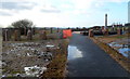
A ring of commemorative stones around Cefn Cribwr War Memorial
The stones encircling the War Memorial http://www.geograph.org.uk/photo/3267547 commemorate
the local people who died in the two World Wars.
Image: © Jaggery
Taken: 7 Dec 2012
0.12 miles
3
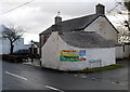
Corner view of The Farmers Arms, Cefn Cribwr
The pub is on the corner of Cefn Road and Ty Fry Road.
Image: © Jaggery
Taken: 7 Dec 2012
0.13 miles
4
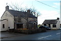
The Farmers Arms, Cefn Cribwr
Viewed across the B4281 Cefn Road, the main road through the village.
The pub is on the corner of Ty Fry Road.
Image: © Jaggery
Taken: 7 Dec 2012
0.13 miles
5
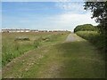
Approaching the common at Cefn Cribwr
Mountain Lane – marked as an ‘other route with public access’ on Ordnance Survey maps – approaches Mynydd Bach Common at Cefn Cribwr.
Image: © eswales
Taken: 15 Jun 2022
0.13 miles
6
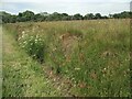
Flora on the common, Cefn Cribwr
Grasses and flowers growing beside Mountain Lane at Mynydd Bach Common.
Image: © eswales
Taken: 15 Jun 2022
0.13 miles
7
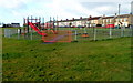
Children's play area, Cefn Cribwr
Located near the eastern end of a recreation area and open space on the south side of the B4281,
the main road through the village.
Image: © Jaggery
Taken: 7 Dec 2012
0.14 miles
8
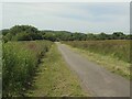
Mynydd Bach Common, Cefn Cribwr (2)
Mountain Lane descends south-westwards away from Cefn Cribwr, which lies about 130 metres above sea level. A horizon of sea and sky is visible in the distance.
Image: © eswales
Taken: 15 Jun 2022
0.14 miles
9
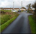
Ty Fry Road, Cefn Cribwr
Looking north towards the B4281, the main road through the village.
Image: © Jaggery
Taken: 7 Dec 2012
0.14 miles
10
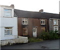
Derelict house, Cefn Road, Cefn Cribwr
Viewed across the B4281 Cefn Road, the main road through the village.
The house's ground floor windows are boarded up and some of the upstairs panes are broken.
Image: © Jaggery
Taken: 7 Dec 2012
0.14 miles