1
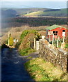
John Street, Cefn Cribwr
A view east from near the corner of The Graig.
Image: © Jaggery
Taken: 7 Dec 2012
0.02 miles
2
Bryn Glas bungalows, Cefn Cribwr
A view east from the corner of The Graig. The course of Bryn Glas is on the north side of Cefn Road and parallel with it.
Image: © Jaggery
Taken: 7 Dec 2012
0.05 miles
3
Cefn Cribwr Garage
The garage's business is used car and van dealers, and a wide range of vehicle-related services, such as vehicle recovery, MoTs, servicing, repairs, car tyre sales and fitting, car air conditioning.
Image: © Jaggery
Taken: 7 Dec 2012
0.06 miles
4
BCLC, Cefn Cribwr
BCLC is Bethlehem Church Life Centre, which opened in Cefn Cribwr in 2005. It is located on the south side of the B4281 Cefn Road, the main road through the village.
Image: © Jaggery
Taken: 7 Dec 2012
0.07 miles
5
Distances from Cefn Cribwr
Viewed across Cefn Road looking towards Bryn Glas bungalows. At the Cefn Cross crossroads ahead, turn left for Llangynwyd (5 miles) or right for Llangewydd (¾ mile) or Laleston (2 miles). Trelales is the Welsh name of Laleston.
Image: © Jaggery
Taken: 7 Dec 2012
0.08 miles
6
The Graig, Cefn Cribwr
Viewed from the corner of John Street. The lane named The Graig descends towards Waun Dafydd Farm.
Image: © Jaggery
Taken: 7 Dec 2012
0.11 miles
7
Nameboard outside the Church of St Colman of Lindisfarne, Cefn Cribwr
The board is on the wall on the right side of this church. http://www.geograph.org.uk/photo/3275921
Image: © Jaggery
Taken: 7 Dec 2012
0.11 miles
8
The Church of St Colman of Lindisfarne, Cefn Cribwr
The Church in Wales church is located near the eastern edge of the village,
on the south side of Cefn Road. The foundation stones were laid on July 5th 1924.
Colman of Lindisfarne was born c605 in Connacht,Ireland, died on August 8th 676. He was a prelate of the early Irish church and monastic founder who led the Celtic party at the Synod of Whitby (663-664).
Image: © Jaggery
Taken: 7 Dec 2012
0.12 miles
9
Housing Estate
Dale View - Golwg y Glyn.
Image: © Alan Hughes
Taken: 7 Jun 2016
0.12 miles
10
Blocked & Damaged Stile
Image: © Adrian Dust
Taken: 3 Sep 2021
0.12 miles


