
IMAGES TAKEN NEAR TO
Careg Llwyd, BRIDGEND, CF31 5EH
Introduction
This page details the photographs taken nearby to Careg Llwyd, CF31 5EH by members of the Geograph project.
The Geograph project started in 2005 with the aim of publishing, organising and preserving representative images for every square kilometre of Great Britain, Ireland and the Isle of Man.

There are currently over 7.5m images from over14,400 individuals and you can help contribute to the project by visiting https://www.geograph.org.uk
Image Map
Images are licensed for reuse under creativecommons.org/licenses/by-sa/2.0
Notes
- Clicking on the map will re-center to the selected point.
- The higher the marker number, the further away the image location is from the centre of the postcode.
Image Listing (9 Images Found)
Images are licensed for reuse under creativecommons.org/licenses/by-sa/2.0
Image
Details
Distance
1
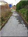
Cycle Track
Cycle track in Broadlands, Bridgend.
Image: © Alan Hughes
Taken: 10 Feb 2016
0.16 miles
2
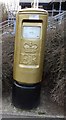
Gold Box on Gentle way, Bridgend
Gold Box for Aled Davies win in Athletics - Men's Discus F42
Image: © Kit Slater
Taken: 27 Mar 2013
0.17 miles
3
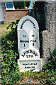
Old Milestone by the A473, Bryntirion Hill, Bridgend parish
Glamorgan Gothic by the A473 (was A48), in parish of Bridgend (Bridgend County Borough District), Bryntirion Hill, 100m East of junction with the B4622, against wall.
Inscription reads:-
: TO / BRIDGEND / 1 : : BRIDGEND DISTRICT : : TO / PYLE / 5 : : LONDON / 178 : : NEWCASTLE PARISH :
Surveyed
Milestone Society National ID: GLA_178BEPY01
Image: © Milestone Society
Taken: Unknown
0.23 miles
4
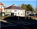
Bryntirion Hill bus stop, shelter and postbox in Bridgend
Viewed across the A473 Bryntirion Hill in the west of the town of Bridgend,
on Christmas Eve 2014, a day of bright sunshine and deep shadows.
The red postbox http://www.geograph.org.uk/photo/4293263 on the right is from the reign of King George VI.
Image: © Jaggery
Taken: 24 Dec 2014
0.23 miles
5

King George VI postbox, Bryntirion Hill, Bridgend
On the right here. http://www.geograph.org.uk/photo/4293259
Image: © Jaggery
Taken: 24 Dec 2014
0.23 miles
6
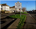
Welcome to the town of Bridgend
Alongside the A473 Bryntirion Hill at the western edge of the town of Bridgend.
With a population of c40,000 Bridgend is the largest town in Bridgend County Borough.
It has about twice the population of the two next biggest, Maesteg and Porthcawl.
Image: © Jaggery
Taken: 24 Dec 2014
0.24 miles
7
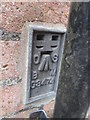
Ordnance Survey Flush Bracket
This OS Flush Bracket can be found on No33 Bryntirion Hill. It marks a point 42.730m above mean sea level.
Image: © Adrian Dust
Taken: 9 Mar 2016
0.24 miles
8
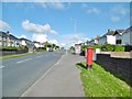
Bridgend, postbox
On Bryntirion Hill; ID CF31 97D.
Image: © Mike Faherty
Taken: 13 Jul 2016
0.24 miles
9
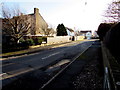
Bryntirion Close, Bridgend
Cul-de-sac on the south side of the A473 Bryntirion Hill.
Image: © Jaggery
Taken: 24 Dec 2014
0.25 miles