IMAGES TAKEN NEAR TO
Pen-y-Fai, BRIDGEND, CF31 4LW
Introduction
This page details the photographs taken nearby to CF31 4LW by members of the Geograph project.
The Geograph project started in 2005 with the aim of publishing, organising and preserving representative images for every square kilometre of Great Britain, Ireland and the Isle of Man.

There are currently over 7.5m images from over14,400 individuals and you can help contribute to the project by visiting https://www.geograph.org.uk
Image Map
Images are licensed for reuse under creativecommons.org/licenses/by-sa/2.0
Notes
- Clicking on the map will re-center to the selected point.
- The higher the marker number, the further away the image location is from the centre of the postcode.
Image Listing (22 Images Found)
Images are licensed for reuse under creativecommons.org/licenses/by-sa/2.0
Image
Details
Distance
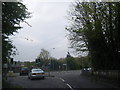
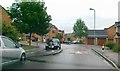
1
Bridgend : Bridgend Road A4063
A road heading into Bridgend.
Image: © Lewis Clarke
Taken: 24 Aug 2014
0.11 miles
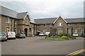
2
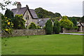
Bridgend : Angelton Villa
Looking towards a house on the Bridgend outskirts.
Image: © Lewis Clarke
Taken: 24 Aug 2014
0.14 miles
3

Bridgend : Renault Dealership
A Renault car dealership on Bridgend Road.
Image: © Lewis Clarke
Taken: 24 Aug 2014
0.15 miles
4
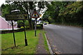
Lane from Pen-y-fai at junction with Bridgend Road
Image: © Colin Pyle
Taken: 4 May 2012
0.16 miles
5
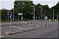
Bridgend : Tondu Road A4063
Tondu Road at the traffic lights with Heol Pen-y-Fai heading off from the road.
Image: © Lewis Clarke
Taken: 24 Aug 2014
0.17 miles
6
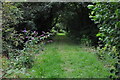
Bridgend : Grassy Path
A grassy path alongside the River Ogmore which doesn't lead anywhere.
Image: © Lewis Clarke
Taken: 24 Aug 2014
0.18 miles
7
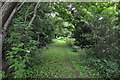
Bridgend : Grassy Path
A grassy path heading alongside the River Ogmore.
Image: © Lewis Clarke
Taken: 24 Aug 2014
0.20 miles
10
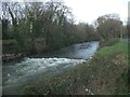
The River Ogmore at Wildmill, Bridgend
The river is seen flowing over a weir on a stretch adjacent to St Christopher’s Road at the western edge of Bridgend.
Image: © eswales
Taken: 1 Jan 2023
0.20 miles