1
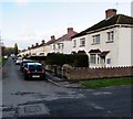
Tynton Road houses, Bridgend
Viewed from Lewis Avenue. Tynton Road is between Tondu Road
and the River Ogmore, near the Brewery Field rugby ground.
Image: © Jaggery
Taken: 24 Dec 2014
0.03 miles
2
Looking upstream along the River Ogmore, Bridgend
The view upstream from the bridge connecting Quarella Road with Brewery Lane and Tesco's car park. Despite the location near the centre of Bridgend, this view gives the impression of a rural setting, in contrast to the urban view from the other side. http://www.geograph.org.uk/photo/1692133
Image: © Jaggery
Taken: 26 Oct 2009
0.11 miles
3
Bridgend : Quarella Road
Looking along Quarella Road and the houses on either side.
Image: © Lewis Clarke
Taken: 24 Aug 2014
0.14 miles
4
Brewery Field
Image: © Colin Pyle
Taken: 4 May 2012
0.14 miles
5
Victorian postbox, Quarella Road, Bridgend
On the east side of Quarella Road, almost opposite The Beeches. http://www.geograph.org.uk/photo/1692094
Image: © Jaggery
Taken: 26 Oct 2009
0.14 miles
6
Road to Ron Skinner
Past Booker to Ron Skinner car sales outlet.
Image: © Steve Barnes
Taken: 23 Jun 2019
0.14 miles
7
New flats, off Quarella Road, Bridgend
Image: © Alex McGregor
Taken: 17 Jun 2011
0.15 miles
8
End of terrace, Newcastle - Bridgend
The exposed brick would perhaps suggest the line of a flue system for a chimney.
Image: © Mick Lobb
Taken: 17 Dec 2009
0.15 miles
9
West side of the Brewery Field stadium, Bridgend
The home of Bridgend Ravens (formerly Bridgend Rugby Football Club), viewed across Tondu Road.
Image: © Jaggery
Taken: 24 Dec 2014
0.16 miles
10
Bridgend : The Beeches
Looking towards parking beside the Beeches off of Quarella Road.
Image: © Lewis Clarke
Taken: 24 Aug 2014
0.16 miles


