
IMAGES TAKEN NEAR TO
Coed Parc, Park Street, BRIDGEND, CF31 4FH
Introduction
This page details the photographs taken nearby to Coed Parc, Park Street, CF31 4FH by members of the Geograph project.
The Geograph project started in 2005 with the aim of publishing, organising and preserving representative images for every square kilometre of Great Britain, Ireland and the Isle of Man.

There are currently over 7.5m images from over14,400 individuals and you can help contribute to the project by visiting https://www.geograph.org.uk
Image Map
Images are licensed for reuse under creativecommons.org/licenses/by-sa/2.0
Notes
- Clicking on the map will re-center to the selected point.
- The higher the marker number, the further away the image location is from the centre of the postcode.
Image Listing (356 Images Found)
Images are licensed for reuse under creativecommons.org/licenses/by-sa/2.0
Image
Details
Distance
1
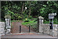
Bridgend : Park Entrance
An entrance into a park off of Park Road.
Image: © Lewis Clarke
Taken: 24 Aug 2014
0.05 miles
2
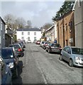
Cae Dre Street, Bridgend
A residential cul-de-sac near the town centre and a popular place to park, based on the evidence of this view. The light brown building on the right is part of Beynon's Dental Surgery. Their premises extend around the corner into Park Street.
Image: © Jaggery
Taken: 12 Feb 2011
0.05 miles
3
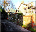
House renovation work on the north side of Park Street, Bridgend
Viewed in late December 2014. I don't know whether this small structure
is a house or an extension of the house it adjoins on the right.
Image: © Jaggery
Taken: 24 Dec 2014
0.06 miles
4
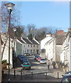
Newcastle Hill, Bridgend
A residential street named Newcastle Hill climbs away from the corner of Park Street and Tondu Road.
Image: © Jaggery
Taken: 12 Feb 2011
0.06 miles
6
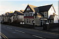
Park Street houses in Bridgend
Viewed across Park Street east of the St Leonard's Road junction, west of the Glan-y-Parc junction.
Image: © Jaggery
Taken: 24 Dec 2014
0.07 miles
7
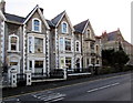
Jaclyn House, Bridgend
Jaclyn House on the left, on the south side of the A473 Park Street,
is the only named house among several similar adjacent houses.
Image: © Jaggery
Taken: 24 Dec 2014
0.08 miles
8
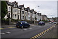
Bridgend : Park Street A473
Looking along Park Street in Bridgend.
Image: © Lewis Clarke
Taken: 24 Aug 2014
0.08 miles
9
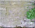
Ordnance Survey Cut Mark
This OS cut mark can be found on the wall of West Cottage, West Road. It marks a point 45.296m above mean sea level.
Image: © Adrian Dust
Taken: 26 May 2018
0.09 miles
10
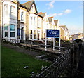
Park Street Dental in Bridgend
Dental practice at 26 Park Street.
Image: © Jaggery
Taken: 24 Dec 2014
0.09 miles