
IMAGES TAKEN NEAR TO
Trem Y Berllan, CF31 4FA
Introduction
This page details the photographs taken nearby to Trem Y Berllan, CF31 4FA by members of the Geograph project.
The Geograph project started in 2005 with the aim of publishing, organising and preserving representative images for every square kilometre of Great Britain, Ireland and the Isle of Man.

There are currently over 7.5m images from over14,400 individuals and you can help contribute to the project by visiting https://www.geograph.org.uk
Image Map
Images are licensed for reuse under creativecommons.org/licenses/by-sa/2.0
Notes
- Clicking on the map will re-center to the selected point.
- The higher the marker number, the further away the image location is from the centre of the postcode.
Image Listing (22 Images Found)
Images are licensed for reuse under creativecommons.org/licenses/by-sa/2.0
Image
Details
Distance
1
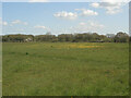
Field and woodland at the northwestern edge of Bridgend
A public footpath on the Bridgend Circular Walk passes through this field. A short stretch of it can be made out running across the picture in the foreground.
The image looks towards the western boundary of extensive woodland just to the north of the western half of Bridgend.
Image: © eswales
Taken: 25 Apr 2023
0.14 miles
2

Main building in the Kymco Stadium, Bryntirion, Bridgend
On the east side of the football pitch in the Kymco Stadium, the home ground of Penybont Football Club.
Image: © Jaggery
Taken: 16 Nov 2018
0.16 miles
3
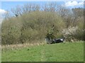
The Bridgend Circular Walk approaching woodland on the south side of the Ffornwg valley
A public footpath on the circular walk heads toward a kissing gate where it begins its passage through a wooded area at the far western end of the extensive woodland on the south side of the Ffornwg valley, and just to the north of the town. That woodland is narrow at this point, and the wooded stretch of the walk here therefore short. Once in the woodland, however, the route that should be taken is not altogether clear. On the day though the kissing gate enabling the wooded area to be exited to the south and the walk continued was found without too much difficulty.
Image: © eswales
Taken: 25 Apr 2023
0.18 miles
4

Entrance to the Kymco Stadium from Llangewydd Road, Bridgend
In November 2018 the Kymco Stadium is the home ground of Penybont Football Club. A June 2011 Google Earth Street View shows that the Kymco Stadium was Bryntirion Park at that time, the home ground of Bryntirion Athletic Football Club (FC). Penybont Football Club was formed in 2013 on the merger of Bridgend Town FC and Bryntirion Athletic FC. Pen-y-bont (or Pen-y-bont ar Ogwr) is the Welsh name for Bridgend.
Image: © Jaggery
Taken: 16 Nov 2018
0.20 miles
5
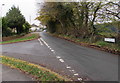
Junction of Mount Pleasant and Llangewydd Road, Bryntirion, Bridgend
From the left, Mount Pleasant joins Llangewydd Road.
Image: © Jaggery
Taken: 16 Nov 2018
0.20 miles
6
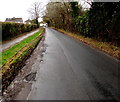
West along Llangewydd Road, Bryntirion, Bridgend
The entrance to the Kymco Stadium https://www.geograph.org.uk/photo/5977263 is behind the camera.
Image: © Jaggery
Taken: 16 Nov 2018
0.20 miles
7

Penybont Football Club banner, Llangewydd Road, Bridgend
In November 2018, the banner shows Welcome to Bryntirion Park - Home of Penybont Football Club, though Bryntirion Park has been renamed the Kymco Stadium. https://www.geograph.org.uk/photo/5977263
Image: © Jaggery
Taken: 16 Nov 2018
0.20 miles
8
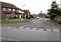
Banc yr Allt, Bridgend
Cul-de-sac on the north side of Llangewydd Road.
Image: © Jaggery
Taken: 16 Nov 2018
0.20 miles
9

Entrance to Football Ground
This is the home ground of Penybont F.C. a Welsh football club formed in 2013 following the merger of Bridgend Town F.C. and Bryntirion Athletic F.C.
Image: © Steve Barnes
Taken: 23 Jun 2019
0.20 miles
10
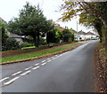
Llangewydd Road west of Mount Pleasant, Bryntirion, Bridgend
The Mount Pleasant junction is on the left. The road ahead leads to Llangewydd Court Farm and Llangewydd Hall.
Image: © Jaggery
Taken: 16 Nov 2018
0.21 miles