1
Bryntirion Hill bus stop, shelter and postbox in Bridgend
Viewed across the A473 Bryntirion Hill in the west of the town of Bridgend,
on Christmas Eve 2014, a day of bright sunshine and deep shadows.
The red postbox http://www.geograph.org.uk/photo/4293263 on the right is from the reign of King George VI.
Image: © Jaggery
Taken: 24 Dec 2014
0.05 miles
2
Bridgend, postbox
On Bryntirion Hill; ID CF31 97D.
Image: © Mike Faherty
Taken: 13 Jul 2016
0.05 miles
3
King George VI postbox, Bryntirion Hill, Bridgend
On the right here. http://www.geograph.org.uk/photo/4293259
Image: © Jaggery
Taken: 24 Dec 2014
0.05 miles
4
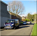
Vehicles parked in Philip Avenue, Bridgend
Looking north from the corner of the A473 Bryntirion Hill.
Nearest the camera is an Ian Morgan (plumbing & heating) van.
Image: © Jaggery
Taken: 24 Dec 2014
0.06 miles
5
Ordnance Survey Flush Bracket
This OS Flush Bracket can be found on No33 Bryntirion Hill. It marks a point 42.730m above mean sea level.
Image: © Adrian Dust
Taken: 9 Mar 2016
0.09 miles
6
Old Milestone by the A473, Bryntirion Hill, Bridgend parish
Glamorgan Gothic by the A473 (was A48), in parish of Bridgend (Bridgend County Borough District), Bryntirion Hill, 100m East of junction with the B4622, against wall.
Inscription reads:-
: TO / BRIDGEND / 1 : : BRIDGEND DISTRICT : : TO / PYLE / 5 : : LONDON / 178 : : NEWCASTLE PARISH :
Surveyed
Milestone Society National ID: GLA_178BEPY01
Image: © Milestone Society
Taken: Unknown
0.09 miles
7
Entrance to Leckwith Cottage, Bryntirion Hill, Bridgend
A rather unconvincing name for the fairly substantial house visible within!
Image: © John Lord
Taken: 26 May 2011
0.09 miles
8
Former Police Station
This former police station still shows up on the OS maps but is now used to run a counselling business.
Image: © Steve Barnes
Taken: 16 Jun 2019
0.10 miles
9
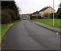
Bryn Awelon, Bridgend
From Heol-y-frenhines along Bryn Awelon towards Philip Avenue.
Image: © Jaggery
Taken: 16 Nov 2018
0.11 miles
10
Welcome to the town of Bridgend
Alongside the A473 Bryntirion Hill at the western edge of the town of Bridgend.
With a population of c40,000 Bridgend is the largest town in Bridgend County Borough.
It has about twice the population of the two next biggest, Maesteg and Porthcawl.
Image: © Jaggery
Taken: 24 Dec 2014
0.12 miles


