1
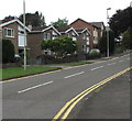
Houses at the eastern end of Park Court Road, Bridgend
Houses on the north side of the road viewed from Angel Street.
Image: © Jaggery
Taken: 29 May 2017
0.02 miles
2
Plaque on Pilgrims Way Bridge
Giving details of the 2000 renovation.
Image: © Steve Barnes
Taken: 15 Feb 2019
0.05 miles
3
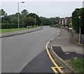
West along Park Court Road, Bridgend
Viewed from the corner of Glan-y-parc.
Image: © Jaggery
Taken: 29 May 2017
0.05 miles
4
Pilgrim's Way Bridge
On the Cycle way at the edge of Newbridge Fields, Bridgend lies a bridge over one of the brooks that feed into the river
Image: © Steve Barnes
Taken: 15 Feb 2019
0.06 miles
5
Glan-y-parc, Bridgend
Houses on the west side of the road, viewed from the corner of Parkfields Road.
The east side of Glan-y-parc is the perimeter of a site occupied by offices.
Image: © Jaggery
Taken: 12 Feb 2011
0.06 miles
6
Narrow Bridge
No side rails so cross with care & single file!
Image: © Steve Barnes
Taken: 15 Feb 2019
0.07 miles
7
Nant Cefn-glas, Bridgend
A short tributary of the River Ogmore which, maps indicate, extends little beyond the boundary of the town. In the picture, which was taken on a small bridge at the northern end of the Broadlands Cycle Route, the stream is seen low in water during a dry spell.
Image: © eswales
Taken: 8 Jun 2021
0.07 miles
8
Junction of Park Court Road and Glan-y-parc, Bridgend
The eastern end of Park Court Road viewed across the road named Glan-y-parc.
The speed limit is 20mph ahead.
Image: © Jaggery
Taken: 29 May 2017
0.07 miles
9
Queen Elizabeth II pillarbox, Park Court Road, Bridgend
Located here. http://www.geograph.org.uk/photo/5408184
Image: © Jaggery
Taken: 29 May 2017
0.07 miles
10
Glan-y-parc houses, Bridgend
Houses on the west side of the road named Glan-y-parc are between Park Court Road and Parkfields Road.
Image: © Jaggery
Taken: 29 May 2017
0.07 miles


