IMAGES TAKEN NEAR TO
Cae Dre Street, BRIDGEND, CF31 4AY
Introduction
This page details the photographs taken nearby to Cae Dre Street, CF31 4AY by members of the Geograph project.
The Geograph project started in 2005 with the aim of publishing, organising and preserving representative images for every square kilometre of Great Britain, Ireland and the Isle of Man.

There are currently over 7.5m images from over14,400 individuals and you can help contribute to the project by visiting https://www.geograph.org.uk
Image Map
Images are licensed for reuse under creativecommons.org/licenses/by-sa/2.0
Notes
- Clicking on the map will re-center to the selected point.
- The higher the marker number, the further away the image location is from the centre of the postcode.
Image Listing (625 Images Found)
Images are licensed for reuse under creativecommons.org/licenses/by-sa/2.0
Image
Details
Distance
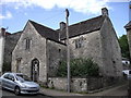
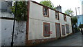
2
Bridgend : Newcastle Hill
Looking up Newcastle Hill in Bridgend.
Image: © Lewis Clarke
Taken: 24 Aug 2014
0.03 miles
3
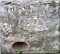
Ordnance Survey Cut Mark
This OS cut mark can be found on the wall of No19 Newcastle Hill. It marks a point 27.615m above mean sea level.
Image: © Adrian Dust
Taken: 26 May 2018
0.03 miles
4
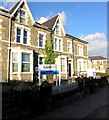
G&W Solicitors in Bridgend
The Gaskell & Walker solicitors office is at 12 Park Street.
Image: © Jaggery
Taken: 24 Dec 2014
0.03 miles
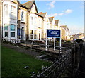
5
Newcastle Hill, Bridgend
Newcastle Hill, Bridgend, former Talbot Arms public house
Image: © Colin Prosser
Taken: 29 Apr 2023
0.04 miles
6
Park Street Dental in Bridgend
Dental practice at 26 Park Street.
Image: © Jaggery
Taken: 24 Dec 2014
0.04 miles
8
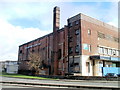
Former Ritz Bingo Hall, Bridgend
Derelict building between Tondu Road and Brewery Lane. The full name shown on the building is "Ritz Luxury Bingo and Social Club". It was built as a cinema. http://www.geograph.org.uk/photo/1606429 to a potted history.
Image: © Jaggery
Taken: 12 Feb 2011
0.04 miles
9
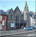
Bridgend United Church
Located on Tondu Road. Formerly named Wesley Methodist, the church was renamed in 2000 on uniting with Bridgend United Reformed Church.
Image: © Jaggery
Taken: 12 Feb 2011
0.04 miles
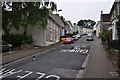
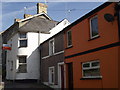
10
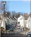
Newcastle Hill, Bridgend
A residential street named Newcastle Hill climbs away from the corner of Park Street and Tondu Road.
Image: © Jaggery
Taken: 12 Feb 2011
0.04 miles