1
Bridgend, civic offices
Seat of Bridgend County Borough Council, on Angel Street. Perhaps its resemblance to a large bunker is coincidental.
Image: © Mike Faherty
Taken: 12 Jul 2016
0.04 miles
2
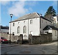
The Old Meeting House, Bridgend
Located on the corner of Park Street and Newcastle Hill. There are no name signs remaining at the site, but a faded inscription in stone above the two large windows shows ERECTED 1795.
Image: © Jaggery
Taken: 12 Feb 2011
0.04 miles
3
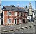
Bridgend United Services Club
The slightly curved shape of the building follows the bend in the road. Located at 1 Tondu Road. The grey tower is part of Bridgend United Church. http://www.geograph.org.uk/photo/2280900
Image: © Jaggery
Taken: 12 Feb 2011
0.04 miles
4
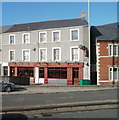
An Khang restaurant, Bridgend
Restaurant serving Cantonese and Vietnamese cuisine, 2-4 Park Street, on the corner of Tondu Road.
Image: © Jaggery
Taken: 12 Feb 2011
0.04 miles
5
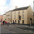
Two Angels, Bridgend
The large building is on the corner of Park Street and Tondu Road. In the foreground is Angel Fish Bar and Restaurant. Behind it is the New Angel Inn.
Image: © Jaggery
Taken: 12 Feb 2011
0.04 miles
6
Bridgend Council Offices - viewed from Old Bridge
Image: © Betty Longbottom
Taken: 26 Jun 2019
0.04 miles
7
Council offices under wraps and scaffolding, Angel Street, Bridgend
Viewed on May 29th 2017.
Image: © Jaggery
Taken: 29 May 2017
0.04 miles
8
Eastern end of Park Street, Bridgend
Park Street is part of the A473. Signs on the left show 7 miles to Porthcawl, 1¾ to Laleston.
Image: © Jaggery
Taken: 29 May 2017
0.05 miles
9
The Wyndham Arms, Bridgend
Wetherspoons hotel located on Dunraven Place and Cross Street in central Bridgend.
Dating from 1792, now modernised to 21st century standards, the hotel has 25 bedrooms, all en-suite.
Image: © Jaggery
Taken: 12 Feb 2011
0.05 miles
10
River Ogmore footbridge, Bridgend
Viewed from Water Street bridge. Visible on the left side of the bridge are Bridgend County Borough Council offices on Angel Street.
Image: © Jaggery
Taken: 12 Feb 2011
0.05 miles


