IMAGES TAKEN NEAR TO
Horsefair Road, BRIDGEND, CF31 3YN
Introduction
This page details the photographs taken nearby to Horsefair Road, CF31 3YN by members of the Geograph project.
The Geograph project started in 2005 with the aim of publishing, organising and preserving representative images for every square kilometre of Great Britain, Ireland and the Isle of Man.

There are currently over 7.5m images from over14,400 individuals and you can help contribute to the project by visiting https://www.geograph.org.uk
Image Map
Images are licensed for reuse under creativecommons.org/licenses/by-sa/2.0
Notes
- Clicking on the map will re-center to the selected point.
- The higher the marker number, the further away the image location is from the centre of the postcode.
Image Listing (18 Images Found)
Images are licensed for reuse under creativecommons.org/licenses/by-sa/2.0
Image
Details
Distance
1
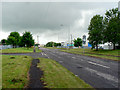
Horsefair Road - Bridgend
Once a lane befitting its name, this is now a service road on the Waterton industrial estate. Many large companies are based here so this and adjacent industrial estates are the source of employment for many who live in Bridgend and nearby communities.
Image: © Mick Lobb
Taken: 9 Jun 2010
0.07 miles
2
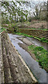
Nant Canna
View downstream from the Horsefair Road the Canna Stream flowing towards its junction with the Afor/River Ewenny, (https://en.wikipedia.org/wiki/Ewenny_River), judging from the flood defences this is a slack time for the stream.
Image: © Steve Barnes
Taken: 27 Mar 2021
0.09 miles
3
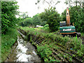
Environmental improvements to the Nant Ganna in progress - Treose
Image: © Mick Lobb
Taken: 9 Jun 2010
0.10 miles
4
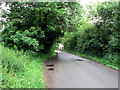
Passing place and lane - Treoes
Beside the Nant Ganna and immediately east of the Waterton industrial estate this little lane takes a circular route back to Treoes and back in time. Ahead lies a busy dual carriageway to and from the M4 but beside it runs this tranquil lane with wooded hedgerows and verdant pastures on each side.
Image: © Mick Lobb
Taken: 9 Jun 2010
0.11 miles
6
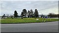
Roundabout with ring of stones
This roundabout between Brocastle Avenue, Moor Road & Horsefair Road features a ring of standing stones.
Image: © Steve Barnes
Taken: 27 Mar 2021
0.12 miles
7
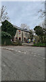
Farm Building
Despite the run down look still in use! None of the maps that I have looked at give a name for the farm, or even the roads that it sits at the junction of.
Image: © Steve Barnes
Taken: 27 Mar 2021
0.12 miles
8
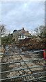
Manure Pile with Farmhouse behind
I suspect that the occupants of the farmhouse keep the windows closed a lot of the time!
Image: © Steve Barnes
Taken: 27 Mar 2021
0.13 miles
9
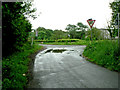
Lane junction - Treose
Approaching the junction with Horsefair Road. Just to the right the lane widens to become a service road on the Waterton industrial estate.
Image: © Mick Lobb
Taken: 9 Jun 2010
0.14 miles