IMAGES TAKEN NEAR TO
Moor Road, BRIDGEND, CF31 3TR
Introduction
This page details the photographs taken nearby to Moor Road, CF31 3TR by members of the Geograph project.
The Geograph project started in 2005 with the aim of publishing, organising and preserving representative images for every square kilometre of Great Britain, Ireland and the Isle of Man.

There are currently over 7.5m images from over14,400 individuals and you can help contribute to the project by visiting https://www.geograph.org.uk
Image Map
Images are licensed for reuse under creativecommons.org/licenses/by-sa/2.0
Notes
- Clicking on the map will re-center to the selected point.
- The higher the marker number, the further away the image location is from the centre of the postcode.
Image Listing (15 Images Found)
Images are licensed for reuse under creativecommons.org/licenses/by-sa/2.0
Image
Details
Distance
1
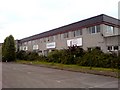
Abandoned Smith Kendon Altoids factory
Until 2005, all the tins of Altoids curiously strong mints in the world were manufactured here in a factory in Bridgend. The brand even traded on its "Made in Great Britain" in advertising and packaging in America, where they were mostly consumed.
The brand was bought by Wrigley's and within 12 months, nearly 200 people were made redundant and the building still stands empty to this day, still bearing its original company name and 3 decaying signs displaying the product it once made, not to mention a couple of years of unkempt bushes making the place look rather sad and tatty now.
On one hand, it made sense to a big corporation as the product was hardly known by the general UK population - but on the other hand a sad end to a tradition of sweet making that has been on UK soil since the 1780s.
Altoids are now made in a plant in Chatanooga, Tennessee and the tin now looks strangely bare without the once familiar "MADE IN GREAT BRITAIN" on its top.
Image: © Hywel Williams
Taken: 25 Jun 2008
0.01 miles
2

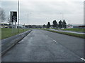
Roundabout with ring of stones
This roundabout between Brocastle Avenue, Moor Road & Horsefair Road features a ring of standing stones.
Image: © Steve Barnes
Taken: 27 Mar 2021
0.06 miles
4
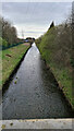
Afon Ewenni/Ewenny River
This section is dead straight.
Image: © Steve Barnes
Taken: 27 Mar 2021
0.15 miles
5
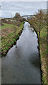
Afon Ewenni/Ewenny River
In this direction the river curves to the north.
Image: © Steve Barnes
Taken: 27 Mar 2021
0.17 miles
7

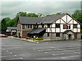
Waterton Industrial Estate
John Raymond's warehouse on Waterton Industrial Estate.
Image: © Alan Hughes
Taken: 4 Aug 2016
0.19 miles
8
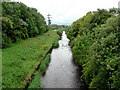
River Ewenny - Bridgend
With development of the landscape rivers are often diverted or starightened. Here the river has been engineered to afford development of local industrial sites.
Image: © Mick Lobb
Taken: 9 Jun 2010
0.19 miles
9
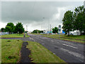
Horsefair Road - Bridgend
Once a lane befitting its name, this is now a service road on the Waterton industrial estate. Many large companies are based here so this and adjacent industrial estates are the source of employment for many who live in Bridgend and nearby communities.
Image: © Mick Lobb
Taken: 9 Jun 2010
0.21 miles