
IMAGES TAKEN NEAR TO
Technology Drive, BRIDGEND, CF31 3LU
Introduction
This page details the photographs taken nearby to Technology Drive, CF31 3LU by members of the Geograph project.
The Geograph project started in 2005 with the aim of publishing, organising and preserving representative images for every square kilometre of Great Britain, Ireland and the Isle of Man.

There are currently over 7.5m images from over14,400 individuals and you can help contribute to the project by visiting https://www.geograph.org.uk
Image Map
Images are licensed for reuse under creativecommons.org/licenses/by-sa/2.0
Notes
- Clicking on the map will re-center to the selected point.
- The higher the marker number, the further away the image location is from the centre of the postcode.
Image Listing (27 Images Found)
Images are licensed for reuse under creativecommons.org/licenses/by-sa/2.0
Image
Details
Distance
1
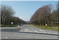
Tree-lined Technology Drive, Bridgend
Still bare in late March, trees line Technology Drive on the west side of the B4265 Ewenny Road.
Image: © Jaggery
Taken: 30 Mar 2014
0.03 miles
2
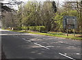
Distances south from Bridgend
Viewed across the B4265 Ewenny Road. The sign shows 4 miles to Ogmore-by-sea, 9 to Llantwit Major.
Image: © Jaggery
Taken: 30 Mar 2014
0.07 miles
3
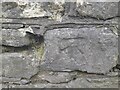
Ordnance Survey Cut Mark
This OS cut mark can be found on the wall SE side of Ewenny Road. It marks a point 32.810m above mean sea level.
Image: © Adrian Dust
Taken: 7 Jun 2022
0.08 miles
4
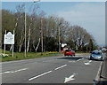
Welcome to the town of Bridgend
The Welcome sign is alongside the B4265 Ewenny Road, at the southern edge of Bridgend
(Pen-y-bont ar Ogwr in Welsh), a town of about 15,000 inhabitants in Bridgend County Borough.
Image: © Jaggery
Taken: 30 Mar 2014
0.09 miles
5
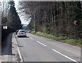
End of the 30mph zone south of Bridgend
The speed limit increases to 40mph along the B4265 Ewenny Road.
Image: © Jaggery
Taken: 30 Mar 2014
0.10 miles
7
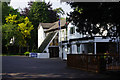
Heronston Hotel
Modern Best Western hotel and spa on Ewenny Road, in the suburbs of Bridgend.
Image: © Stephen McKay
Taken: 28 May 2016
0.10 miles
8
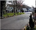
Heronston Hotel near Bridgend
A 5mph speed limit is shown along the hotel entrance road from the B4265 Ewenny Road.
The full name of the hotel in 2014 is Best Western Heronston Hotel & Spa.
Image: © Jaggery
Taken: 30 Mar 2014
0.11 miles
9
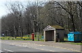
Items alongside a Ewenny Road bus shelter, Bridgend
Located opposite Priory Avenue. http://www.geograph.org.uk/photo/4083497 A litter bin and a blue paperbank are on the right.
A bench, bus stop sign on a lamppost and a King George V postbox are on the left (south) side.
Image: © Jaggery
Taken: 30 Mar 2014
0.11 miles
10
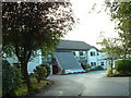
Heronston Hotel
View from the end of the drive.
Image: © Chris Shaw
Taken: 27 Jul 2006
0.12 miles