1
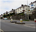
Wyndham Crescent, Bridgend
Wyndham Crescent ascends from Cowbridge Road. The car is near the Fairfield Road junction.
Image: © Jaggery
Taken: 18 Apr 2017
0.04 miles
2
Pedestrian refuge in Cowbridge Road, Bridgend
The refuge in the middle of the A473 Cowbridge Road lets walkers cross half the road width at a time when Cowbridge Road is busy with traffic. Viewed at an untypical traffic-free moment.
Image: © Jaggery
Taken: 18 Apr 2017
0.05 miles
3
Primesight advertising hoarding facing Cowbridge Road, Bridgend
Located on a bank at the edge of this http://www.geograph.org.uk/photo/5355179 railway bridge.
Image: © Jaggery
Taken: 18 Apr 2017
0.06 miles
4
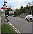
Warning sign - 4.6m/15' 0" headroom bridge ahead, Cowbridge Road, Bridgend
The sign faces the A473 Cowbridge Road on the approach to this http://www.geograph.org.uk/photo/5355179 railway bridge.
Image: © Jaggery
Taken: 18 Apr 2017
0.06 miles
5
Texaco filling station, Cowbridge Road, Bridgend
On the corner of the A473 Cowbridge Road and Wyndham Crescent.
Image: © Jaggery
Taken: 18 Apr 2017
0.07 miles
6
Texaco Petrol Station
Texans petrol station on Cowbridge Road, Bridgend.
Image: © Alan Hughes
Taken: 6 Aug 2016
0.07 miles
7
Nisa Local store, Cowbridge Road, Bridgend
On the west side of this Texaco filling station. http://www.geograph.org.uk/photo/5355111
Image: © Jaggery
Taken: 18 Apr 2017
0.07 miles
8
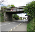
West side of Cowbridge Road railway bridge, Bridgend
The bridge carries the Vale of Glamorgan Line railway over the A473 Cowbridge Road. Headroom shown is 15' 0".
Image: © Jaggery
Taken: 18 Apr 2017
0.07 miles
9
Ordnance Survey Cut Mark
This OS cut mark can be found on the NE buttress of the railway bridge. It marks a point 27.316m above mean sea level.
Image: © Adrian Dust
Taken: 26 May 2018
0.07 miles
10
Queen Elizabeth II pillarbox on a Bridgend corner
On the corner of Uxilla Terrace and Cowbridge Road.
Image: © Jaggery
Taken: 18 Apr 2017
0.08 miles


