
IMAGES TAKEN NEAR TO
Wyndham Crescent, BRIDGEND, CF31 3DN
Introduction
This page details the photographs taken nearby to Wyndham Crescent, CF31 3DN by members of the Geograph project.
The Geograph project started in 2005 with the aim of publishing, organising and preserving representative images for every square kilometre of Great Britain, Ireland and the Isle of Man.

There are currently over 7.5m images from over14,400 individuals and you can help contribute to the project by visiting https://www.geograph.org.uk
Image Map
Images are licensed for reuse under creativecommons.org/licenses/by-sa/2.0
Notes
- Clicking on the map will re-center to the selected point.
- The higher the marker number, the further away the image location is from the centre of the postcode.
Image Listing (66 Images Found)
Images are licensed for reuse under creativecommons.org/licenses/by-sa/2.0
Image
Details
Distance
1
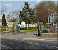
Entrance to Heronsbridge School, Bridgend
On the corner of Ewenny Road and Wyndham Crescent.
Image: © Jaggery
Taken: 30 Mar 2014
0.11 miles
2
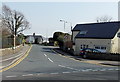
Wyndham Crescent, Bridgend
Viewed across Ewenny Road. The right turn in the middle distance is the Heronston Lane junction.
Image: © Jaggery
Taken: 30 Mar 2014
0.11 miles
3
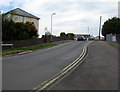
Wyndham Crescent, Bridgend
Wyndham Crescent ascends from Cowbridge Road. The car is near the Fairfield Road junction.
Image: © Jaggery
Taken: 18 Apr 2017
0.11 miles
4
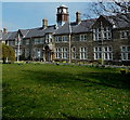
Clock tower, Heronsbridge School, Bridgend
Heronsbridge School is a state special school for boys and girls aged from 3 to 19. The building dates from the early 1930s, erected as Glamorgan County Council School for the Blind.
Image: © Jaggery
Taken: 30 Mar 2014
0.12 miles
5
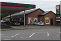
Nisa Local store, Cowbridge Road, Bridgend
On the west side of this Texaco filling station. http://www.geograph.org.uk/photo/5355111
Image: © Jaggery
Taken: 18 Apr 2017
0.12 miles
6
Entrance to Bridgend College, Bridgend
From the A473 Cowbridge Road.
Image: © Jaggery
Taken: 18 Apr 2017
0.13 miles
7
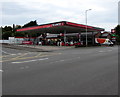
Texaco filling station, Cowbridge Road, Bridgend
On the corner of the A473 Cowbridge Road and Wyndham Crescent.
Image: © Jaggery
Taken: 18 Apr 2017
0.14 miles
8
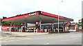
Texaco Petrol Station
Texans petrol station on Cowbridge Road, Bridgend.
Image: © Alan Hughes
Taken: 6 Aug 2016
0.14 miles
9
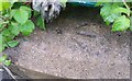
Ordnance Survey Rivet
This OS rivet can be found on the wall of Heronsbridge School. It marks a point 31.452m above mean sea level.
Image: © Adrian Dust
Taken: 26 May 2018
0.14 miles
10
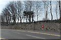
King George V postbox in a long wall, Bridgend
Located opposite Wyndham Crescent, http://www.geograph.org.uk/photo/3940883 the postbox is in the Ewenny Road perimeter wall of Brynteg School.
Image: © Jaggery
Taken: 30 Mar 2014
0.15 miles