1
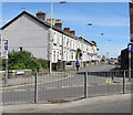
Jenkin Street, Bridgend
From Free School Court along Jenkin Street towards South Place.
Image: © Jaggery
Taken: 18 Apr 2017
0.02 miles
2
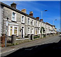
Row of houses, Coychurch Road, Bridgend
Houses between Cowbridge Road and South Place.
Image: © Jaggery
Taken: 18 Apr 2017
0.03 miles
3
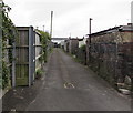
Back lane near Asda Bridgend
On the south side of Free School Court, between the backs of Jenkin Street
houses and the perimeter fence of the Asda superstore http://www.geograph.org.uk/photo/5404392 site.
Image: © Jaggery
Taken: 18 Apr 2017
0.04 miles
4
Jenkin St, Bridgend
Image: © John Lord
Taken: 23 Oct 2010
0.05 miles
5
Bridgend, Coach
Good Beer Guide-listed pub on Cowbridge Road. Internally, simple layout, with central bar, and drinking area left, front and right. 6 cask ales were on offer at my visit, served by handpump or gravity.
Image: © Mike Faherty
Taken: 13 Jul 2016
0.06 miles
6
Cheltenham Terrace, Bridgend
From Free School Court along Cheltenham Terrace towards Suffolk Street.
Image: © Jaggery
Taken: 18 Apr 2017
0.06 miles
7
Cowbridge Road, Bridgend
Looking along the A473, south-east of the town centre.
Image: © Stephen McKay
Taken: 28 May 2016
0.06 miles
8
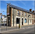
Fish & chips shop on a Bridgend corner
On the corner of Coychurch Road and Cowbridge Road. The name sign shows FISH & CHIPS.
An advertising space, vacant on April 18th 2017, is on the corner of the shop.
Image: © Jaggery
Taken: 18 Apr 2017
0.06 miles
9
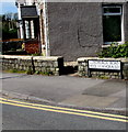
Bilingual street name sign on a Bridgend corner
The sign facing Cowbridge Road shows that Coychurch Road is Heol Llangrallo in Welsh.
Image: © Jaggery
Taken: 18 Apr 2017
0.06 miles
10
Junction of Cowbridge Road and Coychurch Road, Bridgend
The blue and white signs show that Coychurch Road is a one-way road.
Image: © Jaggery
Taken: 18 Apr 2017
0.06 miles


