
IMAGES TAKEN NEAR TO
Dan-y-Coed Rise, BRIDGEND, CF31 2QA
Introduction
This page details the photographs taken nearby to Dan-y-Coed Rise, CF31 2QA by members of the Geograph project.
The Geograph project started in 2005 with the aim of publishing, organising and preserving representative images for every square kilometre of Great Britain, Ireland and the Isle of Man.

There are currently over 7.5m images from over14,400 individuals and you can help contribute to the project by visiting https://www.geograph.org.uk
Image Map
Images are licensed for reuse under creativecommons.org/licenses/by-sa/2.0
Notes
- Clicking on the map will re-center to the selected point.
- The higher the marker number, the further away the image location is from the centre of the postcode.
Image Listing (13 Images Found)
Images are licensed for reuse under creativecommons.org/licenses/by-sa/2.0
Image
Details
Distance
2

NEW
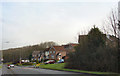
Princess Way, Brackla, between Meadow Walk and Chorleywood Close
Princess Way, Brackla, heading north, shortly after the Chorleywood Close junction. There is a private gated track on the left and, after that, a layby. A bus waits patiently, possibly for a school run.
Image: © Joseph French
Taken: 21 Sep 2026
0.09 miles
3

NEW
Highfields, viewed from Brackla Ridge Playing Area
A view of houses on Highfields, viewed from the open space at the western end of Brackla Ridge Playing Area. There is an alleyway, at the far left of this image, providing direct access to this section of Highfields.
Image: © Joseph French
Taken: 21 Sep 2026
0.14 miles
5

NEW
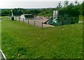
Brackla Ridge Playing Area MUGA
This is the MUGA (Multi-Use Games Area) at Brackla Ridge Playing Area, providing a court for a mixture of sports including football and basketball. The MUGA sits between a skate park (to the west) and a playground (to the east).
Image: © Joseph French
Taken: 21 Sep 2026
0.16 miles
6

NEW
Princess Way, Brackla, between Georgian Way and Chorleywood Close
A view of Princess Way, Brackla, facing north. To the immediate right of the photo is the entrance to Georgian Way. The next turning on the left is Chorleywood Close.
Image: © Joseph French
Taken: 21 Sep 2026
0.16 miles
7
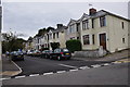
Bridgend : Herbert Street
Herbert Street seen from the junction at Acland Road.
Image: © Lewis Clarke
Taken: 24 Aug 2014
0.18 miles
8
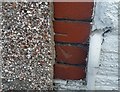
Ordnance Survey Cut Mark
This OS cut mark can be found on No1 Vernon Street. It marks a point 28.651m above mean sea level.
Image: © Adrian Dust
Taken: 26 May 2018
0.19 miles
9
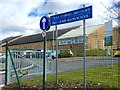
Ysgol Bro Ogwr
Welsh-medium school - Ysgol Bro Ogwr, Brdgend.
Image: © Alan Hughes
Taken: 7 Mar 2016
0.19 miles
10

NEW
Eastern entrance of Brackla Ridge Playing Area
This is the eastern entrance of Brackla Ridge Playing Area, from Brackla Way. The playing area includes a playground, a MUGA court, a skate park, and green space. It also allows for pedestrian travel between Brackla Way and Princess Way.
Image: © Joseph French
Taken: 21 Sep 2026
0.20 miles