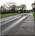
1
Tremains Infants School
Image: © Alex McGregor
Taken: 17 Jun 2011
0.18 miles
2
Fox Hollows houses behind trees, Brackla, Bridgend
Viewed from Simonston Road.
Image: © Jaggery
Taken: 23 Nov 2020
0.18 miles
3
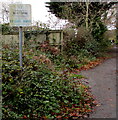
No Fly Tipping notice alongside a path near Coychurch Crematorium
The English and Welsh text on the notice in the background here https://www.geograph.org.uk/photo/6716488 is faded in November 2020.
Image: © Jaggery
Taken: 23 Nov 2020
0.21 miles
4
Boulder across a footpath near Coychurch Crematorium
On the west side of Simonston Road viewed in November 2020.
The crematorium site is behind the camera.
Image: © Jaggery
Taken: 23 Nov 2020
0.21 miles
5
Fallen leaves on the Simonston Road pavement, Bridgend
Viewed on November 23rd 2020.
Image: © Jaggery
Taken: 23 Nov 2020
0.21 miles
6
Junction of Brackla Way and Hawthorn Way, Brackla, Bridgend
Viewed across Brackla Way. Hawthorn Way leads to Maple Drive.
Image: © Jaggery
Taken: 23 Nov 2020
0.22 miles
7
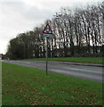
Warning sign - roundabout 200 yds, Simonston Road, Bridgend
On the approach to this https://www.geograph.org.uk/photo/6685801 roundabout.
Image: © Jaggery
Taken: 23 Nov 2020
0.22 miles
8
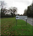
Bilingual Coychurch Crematorium direction sign
The sign facing southbound traffic on Simonston Road
shows that Crematorium is Amlosgfa in Welsh.
Image: © Jaggery
Taken: 23 Nov 2020
0.22 miles
9
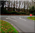
STOP sign at the end of the exit road from the Coychurch Crematorium site
At the Simonston Road junction. The white arrows on the road surface show that this is an exit-only road. The site entrance road is 200 metres to the south (left).
Image: © Jaggery
Taken: 23 Nov 2020
0.22 miles
10
SSE along Simonston Road, Bridgend
Towards Brackla Roundabout 200 yards ahead.
Image: © Jaggery
Taken: 23 Nov 2020
0.22 miles


