IMAGES TAKEN NEAR TO
Mackworth Street, BRIDGEND, CF31 1AG

Introduction

This page details the photographs taken nearby to Mackworth Street, CF31 1AG by members of the Geograph project.

The Geograph project started in 2005 with the aim of publishing, organising and preserving representative images for every square kilometre of Great Britain, Ireland and the Isle of Man.

There are currently over 7.5m images from over14,400 individuals and you can help contribute to the project by visiting https://www.geograph.org.uk

Image Map


Images are licensed for reuse under creativecommons.org/licenses/by-sa/2.0
Notes
  • Clicking on the map will re-center to the selected point.
  • The higher the marker number, the further away the image location is from the centre of the postcode.

Image Listing (225 Images Found)

Images are licensed for reuse under creativecommons.org/licenses/by-sa/2.0
  • ...
Image
Details
Distance
1
HHPG House, Bridgend
Head office of HHPG, located on Coity Road. HHPG is an independent financial planning and mortgage consultancy, focusing on wealth management and business solutions.
Image: © Jaggery Taken: 26 Oct 2009
0.05 miles
2
National Tyres and Autocare, Bridgend
Colourful premises located on Coity Road.
Image: © Jaggery Taken: 26 Oct 2009
0.05 miles
3
Stone boss on sheltered housing - Bridgend
The inscription indicates that the building on which the boss is mounted was built, and have originally been used as offices, for the Bridgend and Cowbridge Water Company.
Image: © Mick Lobb Taken: 3 Dec 2009
0.06 miles
4
Sheltered accommodation at Llys Faen - Bridgend
Appearing much like a terrace of alms houses but with a more industrial origin.
Image: © Mick Lobb Taken: 3 Dec 2009
0.06 miles
5
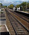
Junction ahead viewed from Bridgend railway station
Looking towards the junction where the line to Maesteg diverges to the right from the main line.
Image: © Jaggery Taken: 10 Oct 2014
0.06 miles
6
Ordnance Survey Cut Mark
This OS cut mark can be found on No56 Coity Road. It marks a point 30.904m above mean sea level.
Image: © Adrian Dust Taken: 26 May 2018
0.07 miles
7
Ordnance Survey Cut Mark
This OS cut mark can be found on the Sheltered Housing on Quarrella Road. It marks a point 20.995m above mean sea level.
Image: © Adrian Dust Taken: 26 May 2018
0.08 miles
8
Quarella Road - Bridgend
The notice board indicates the location of the Quarella Road Clinic.
Image: © Mick Lobb Taken: 3 Dec 2009
0.08 miles
9
Bridgend : Union Offices
The Grade 2 Listed building is constructed with solid masonry elevations under a slate tiled pitched roof. The property features timber casement windows throughout and has imposing pedestrian entrance doorways to both front and rear elevations. Now for sale as a residential property.
Image: © Lewis Clarke Taken: 24 Aug 2014
0.09 miles
10
Quarella Road Clinic, Bridgend
On the corner of Quarella Road and Quarella Gardens (Gerddi Quarella).
Image: © Jaggery Taken: 26 Oct 2009
0.09 miles
  • ...