
IMAGES TAKEN NEAR TO
Florentia Street, CARDIFF, CF24 4PF
Introduction
This page details the photographs taken nearby to Florentia Street, CF24 4PF by members of the Geograph project.
The Geograph project started in 2005 with the aim of publishing, organising and preserving representative images for every square kilometre of Great Britain, Ireland and the Isle of Man.

There are currently over 7.5m images from over14,400 individuals and you can help contribute to the project by visiting https://www.geograph.org.uk
Image Map
Images are licensed for reuse under creativecommons.org/licenses/by-sa/2.0
Notes
- Clicking on the map will re-center to the selected point.
- The higher the marker number, the further away the image location is from the centre of the postcode.
Image Listing (103 Images Found)
Images are licensed for reuse under creativecommons.org/licenses/by-sa/2.0
Image
Details
Distance
1
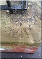
Ordnance Survey Rivet
This damaged OS rivet can be found on the wall of No31 Monthermer Street. It marks a point 21.583m above mean sea level.
Image: © Adrian Dust
Taken: 11 Nov 2017
0.06 miles
2
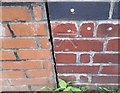
Ordnance Survey Cut Mark
This OS cut mark can be found on No2 Bruce Street. It marks a point 19.730m above mean sea level.
Image: © Adrian Dust
Taken: 11 Nov 2017
0.06 miles
3
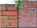
Ordnance Survey Cut Mark
This OS cut mark can be found on No18 Fanny Street. It marks a point 17.297m above mean sea level.
Image: © Adrian Dust
Taken: 11 Nov 2017
0.06 miles
4
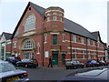
Highfields Church, Monthermer Rd, Cardiff
Originally called Crwys Hall.
Image: © Dylan Moore
Taken: 28 Nov 2005
0.06 miles
5
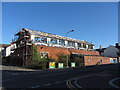
Derelict building on Monthermer Road
According to old OS maps, this was once a mission church, though more latterly it's been a commercial store/factory. But now, the roof and some cladding have gone, exposing some of the interior, and notices suggest it is undergoing demolition.
Image: © Gareth James
Taken: 16 Aug 2014
0.07 miles
6
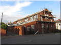
Derelict building on Monthermer Road
According to old OS maps, this was once a mission church, though more latterly it's been a commercial store/factory. But now, the roof and some cladding have gone, exposing some of the interior, and notices suggest it is undergoing demolition.
Image: © Gareth James
Taken: 15 Aug 2014
0.08 miles
7
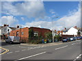
Demolition on Monthermer Road
Demolition of a warehouse, a former mission church, continues.
See also: Image
Image: © Gareth James
Taken: 26 Sep 2014
0.08 miles
8
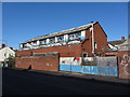
Derelict building on Monthermer Road
According to old OS maps, this was once a mission church, though more latterly it's been a commercial store/factory. But now, the roof and some cladding have gone, exposing some of the interior, and notices suggest it is undergoing demolition.
Image: © Gareth James
Taken: 16 Aug 2014
0.08 miles
9
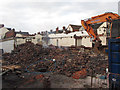
Demolition on Monthermer Road
A former warehouse, originally a mission church, nears the end of its demolition.
See also: Image
Image: © Gareth James
Taken: 28 Sep 2014
0.09 miles
10
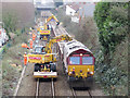
Engineering work on the Rhymney line in Roath
Engineering work concerning trackside drainage took place on Sunday, 3rd February 2019 on the Rhymney line in Cardiff between the Monthermer Road and Crwys Road overbridges. Here DB class 66 locomotive No. 66091 is seen at the work site, with classmate No. 66015 on the other end of the train, which had worked in from Westbury overnight.
Image: © Gareth James
Taken: 3 Feb 2019
0.09 miles