1
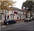
Pentyrch St. Baptist Church, Cardiff
Image: © John Lord
Taken: 27 Jan 2010
0.03 miles
2
Issa Estates office, Cathays, Cardiff
Letting agents' office at 141 Cathays Terrace, on the corner of Llantrissant Street.
Some maps show Llantrisant Street, but the street name sign shows Llantrissant Street.
Image: © Jaggery
Taken: 20 Oct 2013
0.05 miles
3
Cathays Surgery, Cardiff
Originally located in small premises in Woodville Road, Cathays Surgery is now in two converted houses in Cathays Terrace. The practice accepts patients from the Cathays, Heath and Roath areas of Cardiff. The practice boundary also includes parts of Gabalfa, Lakeside and Cyncoed.
Image: © Jaggery
Taken: 20 Oct 2013
0.07 miles
4
Ordnance Survey Cut Mark
This damaged OS cut mark can be found on the wall between Nos174 & 176 Cathays Terrace. It marks a point 21.434m above mean sea level.
Image: © Adrian Dust
Taken: 11 Nov 2017
0.07 miles
5
Ordnance Survey Cut Mark
This OS cut mark can be found on No2 Cosmeston Street. It marks a point 23.073m above mean sea level.
Image: © Adrian Dust
Taken: 11 Nov 2017
0.07 miles
6
Apartment construction in Cathays, Cardiff
This October 2013 view of the corner of Cathays Terrace and May Street shows work at an early stage at a GL Hearn construction site. 14 apartments are being built.
Image: © Jaggery
Taken: 20 Oct 2013
0.08 miles
7
Gladstone Primary School and Nursery Unit, Cardiff
Located on Whitchurch Road near its southeast end at the edge of Crwys Road.
The building dates from 1900.
Image: © Jaggery
Taken: 15 Jul 2010
0.08 miles
8
Public toilets at the SE end of Whitchurch Road, Cardiff
The year 1934 is inscribed in stone on the building, which adjoins the NW edge of Cathays Library. http://www.geograph.org.uk/photo/1984259
Image: © Jaggery
Taken: 10 Apr 2011
0.08 miles
9
St Monica's Church in Wales School, Cardiff
Primary school located on the corner of Whitchurch Road and Pentyrch Street, adjacent to the crossroads with Crwys Road, Cathays Terrace and Fairoak Road.
Image: © Jaggery
Taken: 15 Jul 2010
0.08 miles
10
Cathays Library
This is Cathays Library. Cathays Library is a Carnegie building opened in 1906 and is prominently situated on the junction of Cathays Terrace, Whitchurch Road, Fairoak Road and Crwys Road, next to Cathays Cemetery. It is a Grade 2 Listed building and contains several interesting architectural features
Image: © miriam
Taken: 27 Feb 2005
0.08 miles


