
IMAGES TAKEN NEAR TO
Treherbert Street, CARDIFF, CF24 4JU
Introduction
This page details the photographs taken nearby to Treherbert Street, CF24 4JU by members of the Geograph project.
The Geograph project started in 2005 with the aim of publishing, organising and preserving representative images for every square kilometre of Great Britain, Ireland and the Isle of Man.

There are currently over 7.5m images from over14,400 individuals and you can help contribute to the project by visiting https://www.geograph.org.uk
Image Map
Images are licensed for reuse under creativecommons.org/licenses/by-sa/2.0
Notes
- Clicking on the map will re-center to the selected point.
- The higher the marker number, the further away the image location is from the centre of the postcode.
Image Listing (116 Images Found)
Images are licensed for reuse under creativecommons.org/licenses/by-sa/2.0
Image
Details
Distance
1
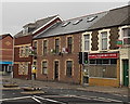
Adams Fish Bar & Punjabi Balti House, Cathays, Cardiff
Viewed across Cathays Terrace near the corner of Treherbert Street (on the left).
Image: © Jaggery
Taken: 20 Oct 2013
0.00 miles
2
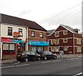
Two Cathays Terrace businesses, Cardiff
There is an estate agents' Sold board on the business on the left, Mrs Jones Caters.
Next door, on the corner of Treherbert Street, is Capital Properties residential lets office.
Image: © Jaggery
Taken: 20 Oct 2013
0.01 miles
3
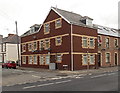
Treherbert Court, Cathays, Cardiff
Flats on the corner of Treherbert Street and Cathays Terrace.
Image: © Jaggery
Taken: 20 Oct 2013
0.01 miles
4
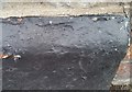
Ordnance Survey Rivet
Just the chopped out stonework for the OS rivet can be found on the garage wall of No116 Cathays Terrace. It marks a point 17,599m above mean sea level.
Image: © Adrian Dust
Taken: 12 Oct 2017
0.02 miles
5
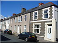
Treherbert Street
Terraced housing in inner city Cardiff. This area, Cathays, now has a large student population, being near to Cardiff and Glamorgan University buildings.
Image: © Colin Smith
Taken: 15 Sep 2007
0.02 miles
6
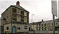
The Flora, Cathays
Another view of the pub shown in Image, with houses along Cathays Terrace in the background.
Image: © Derek Harper
Taken: 16 Jun 2018
0.02 miles
7
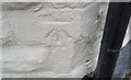
Ordnance Survey Cut Mark
This OS cut mark can be found on The Flora PH. It marks a point 18.309m above mean sea level.
Image: © Adrian Dust
Taken: 12 Oct 2017
0.02 miles
8
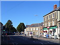
Cathays Terrace
One of the through routes in this inner-city suburb of Cardiff. The pubs located on the street corners, like the Flora here, will attract passing traffic. The corner house beyond the Flora sports Australian and Welsh flags as the two countries were playing each other at rugby in Cardiff that day.
Image: © Colin Smith
Taken: 15 Sep 2007
0.03 miles
9
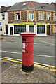
Victorian postbox, Cathays
Victorian postbox number CF24 70 is at the junction of Cathays Terrace and Hirwain Street, opposite Image
Image: © Derek Harper
Taken: 16 Jun 2018
0.03 miles
10
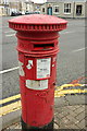
Victorian postbox, Cathays
A close look at Victorian postbox number CF24 70, as shown in Image], with Image] across the road junction.
Image: © Derek Harper
Taken: 16 Jun 2018
0.03 miles