
IMAGES TAKEN NEAR TO
Cathays Terrace, CARDIFF, CF24 4HS
Introduction
This page details the photographs taken nearby to Cathays Terrace, CF24 4HS by members of the Geograph project.
The Geograph project started in 2005 with the aim of publishing, organising and preserving representative images for every square kilometre of Great Britain, Ireland and the Isle of Man.

There are currently over 7.5m images from over14,400 individuals and you can help contribute to the project by visiting https://www.geograph.org.uk
Image Map
Images are licensed for reuse under creativecommons.org/licenses/by-sa/2.0
Notes
- Clicking on the map will re-center to the selected point.
- The higher the marker number, the further away the image location is from the centre of the postcode.
Image Listing (114 Images Found)
Images are licensed for reuse under creativecommons.org/licenses/by-sa/2.0
Image
Details
Distance
1
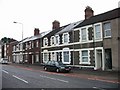
Cathays Terrace, on the road of the same name
Image: © Nick Smith
Taken: 23 Sep 2007
0.01 miles
2
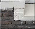
Ordnance Survey Cut Mark
This OS cut mark can be found on No23 Cathays Terrace. It marks a point 17.678m above mean sea level.
Image: © Adrian Dust
Taken: 12 Oct 2017
0.01 miles
3
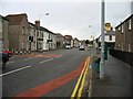
Cathays Terrace junction with Catherine Street
Image: © Nick Smith
Taken: 23 Sep 2007
0.03 miles
4
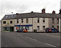
Horizon and Pinnacle in Cathays, Cardiff
Two property sales and letting offices in Catherine Street.
Image: © Jaggery
Taken: 20 Oct 2013
0.04 miles
5
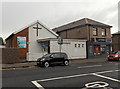
Cardiff International Church, Cathays, Cardiff
Located in Cathays Terrace near the corner of Minster Street.
Image: © Jaggery
Taken: 20 Oct 2013
0.04 miles
6
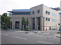
School of Optometry and Vision Sciences, Cardiff University
The School is located at the south end of Maindy Road, adjacent to the railway line up the Taff valley. It was built around 2005 and houses research and teaching facilities as well as an eye clinic for optometry services open to the general public. The block on the right is the main lecture theatre.
Image: © Rudi Winter
Taken: 3 Sep 2010
0.06 miles
7
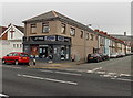
Minister Street, Cathays, Cardiff
Viewed across Cathays Terrace looking along houses on the south side of Minister Street.
On the left are Moginie James Lettings estate agents' office and Cardiff International Church. http://www.geograph.org.uk/photo/3708522
Image: © Jaggery
Taken: 20 Oct 2013
0.07 miles
8
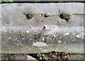
Ordnance Survey Rivet
This damaged OS rivet can be found on the wall of Nos27 & 29 Woodville Road. It marks a point 16.408m above mean sea level.
Image: © Adrian Dust
Taken: 12 Oct 2017
0.08 miles
9
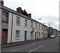
SW end of Fanny Street, Cathays, Cardiff
View from the corner of Catherine Street.
Image: © Jaggery
Taken: 20 Oct 2013
0.08 miles
10
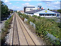
Railway Leaving Cathays
Looking north-west from the Corbett Road railway bridge. On the right is a Lidl supermarket with requisite car park.
Image: © Colin Smith
Taken: 15 Sep 2007
0.09 miles