1
Day centre, Cathays
The 1:25000 map still has this building (also shown in
Image) as a church, although it has been in use for day care since the 1970s. It's not clear from http://www.myprimitivemethodists.org.uk/page/cardiff_dalton_street_primitive_methodist_chapel how old the building is, but it was a Primitive Methodist Chapel.
Image: © Derek Harper
Taken: 16 Jun 2018
0.02 miles
2
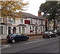
The Magic Centre, Cathays, Cardiff
A studio for all things magical at 27 Dalton Street, on the corner of May Street.
Image: © Jaggery
Taken: 20 Oct 2013
0.04 miles
3
Cathays Surgery, Cardiff
Originally located in small premises in Woodville Road, Cathays Surgery is now in two converted houses in Cathays Terrace. The practice accepts patients from the Cathays, Heath and Roath areas of Cardiff. The practice boundary also includes parts of Gabalfa, Lakeside and Cyncoed.
Image: © Jaggery
Taken: 20 Oct 2013
0.05 miles
4
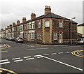
Bricked-up corner of May Street and Dalton Street, Cathays, Cardiff
Perhaps a former corner shop?
Image: © Jaggery
Taken: 20 Oct 2013
0.05 miles
5
Ordnance Survey Cut Mark
This OS cut mark can be found on No83 May Street. It marks a point 18.495m above mean sea level.
Image: © Adrian Dust
Taken: 11 Nov 2017
0.05 miles
6
Victorian postbox, Cathays
Victorian postbox number CF24 70 is at the junction of Cathays Terrace and Hirwain Street, opposite
Image
Image: © Derek Harper
Taken: 16 Jun 2018
0.05 miles
7
Victorian postbox, Cathays
A close look at Victorian postbox number CF24 70, as shown in
Image], with
Image] across the road junction.
Image: © Derek Harper
Taken: 16 Jun 2018
0.05 miles
8
Ordnance Survey Cut Mark
This damaged OS cut mark can be found on the wall between Nos174 & 176 Cathays Terrace. It marks a point 21.434m above mean sea level.
Image: © Adrian Dust
Taken: 11 Nov 2017
0.05 miles
9
Minny Street, Cathays, Cardiff
Streets in this part of Cathays, south of Crwys Road and east of Cathays Terrace, have girls' names.
This is Minny Street, viewed from Dalton Street, looking towards Fanny Street.
Image: © Jaggery
Taken: 15 Jul 2010
0.05 miles
10
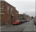
May Street, Cathays, Cardiff
Looking ESE past the corner of Whitchurch Place.
Image: © Jaggery
Taken: 20 Oct 2013
0.05 miles


