1
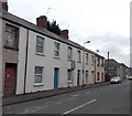
Cathays Terrace junction with Catherine Street
Image: © Nick Smith
Taken: 23 Sep 2007
0.01 miles
2
Horizon and Pinnacle in Cathays, Cardiff
Two property sales and letting offices in Catherine Street.
Image: © Jaggery
Taken: 20 Oct 2013
0.02 miles
3
Cardiff International Church, Cathays, Cardiff
Located in Cathays Terrace near the corner of Minster Street.
Image: © Jaggery
Taken: 20 Oct 2013
0.04 miles
4
SW end of Fanny Street, Cathays, Cardiff
View from the corner of Catherine Street.
Image: © Jaggery
Taken: 20 Oct 2013
0.04 miles
5
Cathays Terrace, on the road of the same name
Image: © Nick Smith
Taken: 23 Sep 2007
0.05 miles
6
Ordnance Survey Cut Mark
This OS cut mark can be found on No23 Cathays Terrace. It marks a point 17.678m above mean sea level.
Image: © Adrian Dust
Taken: 12 Oct 2017
0.05 miles
7
Jupiter, Cathays, Cardiff
Property services and lettings agents office on the corner of Mundy Place and Woodville Road.
The small green shop on the left is The Falafel Bar.
Image: © Jaggery
Taken: 20 Oct 2013
0.08 miles
8
Ordnance Survey Rivet
This damaged OS rivet can be found on the wall of Nos27 & 29 Woodville Road. It marks a point 16.408m above mean sea level.
Image: © Adrian Dust
Taken: 12 Oct 2017
0.08 miles
9
Minny Street Welsh Independent Chapel, Cathays, Cardiff
Actually located a few metres beyond the SE end of Minny Street, on the corner of Fanny Street and Basil Place. The recent planting of trees at the end of Minny Street (a few branches are visible on the right), has blocked vehicular access, further isolating the chapel from its namesake.
The chapel was built in 1887.
Image: © Jaggery
Taken: 15 Jul 2010
0.08 miles
10
ACE MoT test centre, Fanny Street, Cardiff
Located at 11 Fanny Street, close to the Minny Street chapel. http://www.geograph.org.uk/photo/1973612
Image: © Jaggery
Taken: 15 Jul 2010
0.08 miles


