1
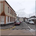
Eglwys Efengylaidd Gymraeg, Cardiff
Welsh-language Evangelical Church located on the corner of Harriet Street and Rhymney Street.
Image: © Jaggery
Taken: 15 Jul 2010
0.02 miles
2
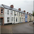
Rhymney Street, Cardiff
Houses on the east side of Rhymney Street, viewed from the edge of the Welsh-language church.http://www.geograph.org.uk/photo/1974520
Image: © Jaggery
Taken: 15 Jul 2010
0.02 miles
3
Thesiger Street, Cathays, Cardiff
Looking north along Thesiger Street. Zem Zem http://www.geograph.org.uk/photo/3711224 is on the left. Wikipedia has nine entries for men with the surname Thesiger, one of whom, presumably, the name of this street commemorates.
Image: © Jaggery
Taken: 20 Oct 2013
0.04 miles
4
Two long lines of cars parked in Richards Street, Cathays, Cardiff
A typical Sunday scene in 2013 in this inner suburb of Cardiff. Viewed from the Mundy Place end looking NNE towards Rhymney Terrace.
Image: © Jaggery
Taken: 20 Oct 2013
0.06 miles
5
Former St Martin's Parish Hall, Cardiff
The only clue to the former usage of this apparently long-disused building on Crwys Road is a faded sign above a doorway on the far side of the building, formerly St Martin's Parish hall. A correspondent informed me that, in the late 1940s, the upstairs area of the hall was used by scouts, guides etc. Downstairs were a stage & hall used for plays etc.
St Martin's church http://www.geograph.org.uk/photo/625333 is a few hundred metres away.
Image: © Jaggery
Taken: 15 Jul 2010
0.08 miles
6
Railway line, Roath
The line from Merthyr Tydfil emerges from beneath the A469 Crwys Road, heading for the city centre. On the immediate left are flats. On the right are houses on Rhymney Street.
Image: © Derek Harper
Taken: 16 Jun 2018
0.08 miles
7
Class 37 in Roath
Another training run prior to the introduction of locomotive-hauled Rhymney-line commuter services, sees class 37 No. 37418 with No. 37421 on the rear, passing through Roath, Cardiff.
Image: © Gareth James
Taken: 14 May 2019
0.09 miles
8
'Hoffi Coffi'
In Welsh '[I] like coffee': coffee bar in Woodville Road, Cathays.
Image: © Natasha Ceridwen de Chroustchoff
Taken: 29 Nov 2007
0.09 miles
9
Fitzroy Street, Cathays, Cardiff
Viewed across Wyeverne Road. Cathays Conservative Club http://www.geograph.org.uk/photo/3711252 is on the left.
Image: © Jaggery
Taken: 20 Oct 2013
0.09 miles
10
Class 47 approaching Crwys Road bridge
Image: © Gareth James
Taken: Unknown
0.09 miles


