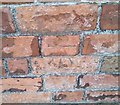
IMAGES TAKEN NEAR TO
Snipe Street, CARDIFF, CF24 3RB

Introduction

This page details the photographs taken nearby to Snipe Street, CF24 3RB by members of the Geograph project.

The Geograph project started in 2005 with the aim of publishing, organising and preserving representative images for every square kilometre of Great Britain, Ireland and the Isle of Man.

There are currently over 7.5m images from over14,400 individuals and you can help contribute to the project by visiting https://www.geograph.org.uk

Image Map


Images are licensed for reuse under creativecommons.org/licenses/by-sa/2.0
Notes
  • Clicking on the map will re-center to the selected point.
  • The higher the marker number, the further away the image location is from the centre of the postcode.

Image Listing (59 Images Found)

Images are licensed for reuse under creativecommons.org/licenses/by-sa/2.0
  • ...
Image
Details
Distance
1
St Anne's School and church, Cardiff
Peering around the corner of the former infant school, now a nursery, is "A Gothic church in early French manner" http://ishare.cardiff.gov.uk/Projects/Cadw/CardiffListedBuildings/14128.pdf . "Begun 1886-7 by J Arthur Reeve, architect". the church is currently unused. Seen from Crofts Street.
Image: © Derek Harper Taken: 16 Jun 2018
0.04 miles
2
Ordnance Survey Cut Mark
This OS cut mark can be found on the SE face of No65 Partridge Road. It marks a point 12.573m above mean sea level.
Image: © Adrian Dust Taken: 12 Oct 2017
0.04 miles
3
Ordnance Survey Cut Mark
This OS cut mark can be found on the NW face of the school. It marks a point 13.701m above mean sea level.
Image: © Adrian Dust Taken: 12 Oct 2017
0.05 miles
4
Ordnance Survey Cut Mark
This damaged OS cut mark can be found on the SE face of No46 Oakfield Street. It marks a point 12.978m above mean sea level.
Image: © Adrian Dust Taken: 12 Oct 2017
0.06 miles
5
Crofts Street, Roath
Seen looking across the crossroads with Cyfarthfa Street. In the centre at the bend is Croft [sic] Street Warehouse, an interior design and hardware store. On the corner is a convenience store. Further down Crofts Street are the buildings shown in Image
Image: © Derek Harper Taken: 16 Jun 2018
0.06 miles
6
Ordnance Survey Cut Mark
This OS cut mark can be found on No115 Cyfarthfa Street. It marks a point 13.862m above mean sea level.
Image: © Adrian Dust Taken: 12 Oct 2017
0.09 miles
7
Hurricane mural
The mural honours Sgt Samuel Butterfield.
Image: © Alan Hughes Taken: 14 May 2021
0.10 miles
8
Lily Street, Cardiff
A terraced street in the Plasnewydd or Roath area of the city between City Road and Albany Road.
Image: © Jeremy Bolwell Taken: 6 Oct 2013
0.10 miles
9
Junction of Treharris Street with Cottrell Road, Roath
The houses are part of the terrace of 23 shown in Image
Image: © Derek Harper Taken: 16 Jun 2018
0.11 miles
10
Ordnance Survey Cut Mark
This OS cut mark can be found on the wall of No32 Claude Road. It marks a point 13.198m above mean sea level.
Image: © Adrian Dust Taken: 12 Oct 2017
0.12 miles
  • ...