
IMAGES TAKEN NEAR TO
Connaught Road, CARDIFF, CF24 3PY
Introduction
This page details the photographs taken nearby to Connaught Road, CF24 3PY by members of the Geograph project.
The Geograph project started in 2005 with the aim of publishing, organising and preserving representative images for every square kilometre of Great Britain, Ireland and the Isle of Man.

There are currently over 7.5m images from over14,400 individuals and you can help contribute to the project by visiting https://www.geograph.org.uk
Image Map
Images are licensed for reuse under creativecommons.org/licenses/by-sa/2.0
Notes
- Clicking on the map will re-center to the selected point.
- The higher the marker number, the further away the image location is from the centre of the postcode.
Image Listing (77 Images Found)
Images are licensed for reuse under creativecommons.org/licenses/by-sa/2.0
Image
Details
Distance
1
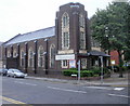
Albany Road Baptist Church, Cardiff
Church on the corner of Albany Road and Blenheim Road. The church was opened in 1919, replacing a 'tin church' on the site.
Image: © Jaggery
Taken: 15 Jul 2010
0.03 miles
2
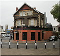
Ichiban restaurant, Albany Road,Cardiff
Located at 167 Albany Road, on the corner of Pen-y-Lan Road.
A Japanese sushi and noodle restaurant, opened in 2007. Ichiban is Japanese for number one.
Image: © Jaggery
Taken: 15 Jul 2010
0.03 miles
3
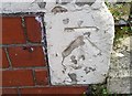
Ordnance Survey Cut Mark
This OS cut mark can be found on No118 Claude Road. It marks a point 12.466m above mean sea level.
Image: © Adrian Dust
Taken: 12 Oct 2017
0.05 miles
4
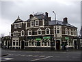
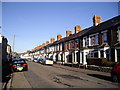
The Claude Hotel, Roath
Built 1890, a period of great expansion in this part of Cardiff.
Image: © Natasha Ceridwen de Chroustchoff
Taken: 29 Nov 2007
0.07 miles
7
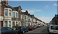
Cottrell Road, Roath
From the junction with Glenroy Road. On the left is a terrace of 40 properties.
Image: © Derek Harper
Taken: 16 Jun 2018
0.08 miles
8
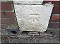
Ordnance Survey Cut Mark
This OS cut mark can be found on No73 Connaught Road. It marks a point 13.061m above mean sea level.
Image: © Adrian Dust
Taken: 12 Oct 2017
0.08 miles
9
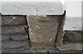
Ordnance Survey Cut Mark
This very damaged OS cut mark can be found on No58 Claude Road. It marks a point 13,533m above mean sea level.
Image: © Adrian Dust
Taken: 12 Oct 2017
0.09 miles
10
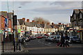
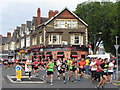
Albany Road
This is the eastern end of the commercial part of the road, containing mostly ethnic food outlets.
Image: © john bristow
Taken: 17 Nov 2012
0.11 miles