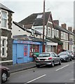
IMAGES TAKEN NEAR TO
City Road, CARDIFF, CF24 3JJ

Introduction

This page details the photographs taken nearby to City Road, CF24 3JJ by members of the Geograph project.

The Geograph project started in 2005 with the aim of publishing, organising and preserving representative images for every square kilometre of Great Britain, Ireland and the Isle of Man.

There are currently over 7.5m images from over14,400 individuals and you can help contribute to the project by visiting https://www.geograph.org.uk

Image Map


Images are licensed for reuse under creativecommons.org/licenses/by-sa/2.0
Notes
  • Clicking on the map will re-center to the selected point.
  • The higher the marker number, the further away the image location is from the centre of the postcode.

Image Listing (125 Images Found)

Images are licensed for reuse under creativecommons.org/licenses/by-sa/2.0
  • ...
Image
Details
Distance
1
The Record Shop, Inverness Place, Cardiff
Were it not for the eye-catching blue colour, you could easily miss this little shop located near the Albany Road end of Inverness Place. A sign on the wall announces "Cash paid for records, tapes and CDs"
Image: © Jaggery Taken: 15 Jul 2010
0.01 miles
2
Re-surfacing work on Albany Road
Image: © Gareth James Taken: 11 May 2013
0.02 miles
3
St Martin's Roath, and pawnbroker
This late C19 Victorian Gothic church was badly damaged during WW2 and extensively rebuilt in 1951. It follows the Catholic tradition within the Church in Wales. Spiritual consolations do not however provide for the immediate material needs of the impoverished who may resort to the next-door establishment instead.
Image: © Natasha Ceridwen de Chroustchoff Taken: 29 Nov 2007
0.02 miles
4
Re-surfacing work on Albany Road
Image: © Gareth James Taken: 12 May 2013
0.03 miles
5
St Martin's church, Roath
On the A469 Albany Road, and shown from the other direction in Image The church is unlisted but described at https://en.wikipedia.org/wiki/St_Martin%27s_Church,_Roath : "founded as a tin tabernacle in 1886. The present building replaced it in 1901".
Image: © Derek Harper Taken: 16 Jun 2018
0.03 miles
6
The Royal George Hotel
On the apex of Crwys Road and Mackintosh Place and looking on to the busy intersection of 5 streets. It was built in 1878, but not completed until 1891, the first publican being Samuel Loveless, nephew of James Hammett, Tolpuddle Martyr. Apparently haunted by Humphrey, a friendly poltergeist. (Information from http://cardiffpubs.co.uk )
Image: © Natasha Ceridwen de Chroustchoff Taken: 29 Nov 2007
0.04 miles
7
Re-surfacing work on Richmond Road
Image: © Gareth James Taken: 11 May 2013
0.05 miles
8
Ordnance Survey Cut Mark
This OS cut mark can be found on the north angle of St Martin's Church. It marks a point 14.637m above mean sea level.
Image: © Adrian Dust Taken: 12 Oct 2017
0.05 miles
9
Ordnance Survey Cut Mark
This damaged OS cut mark can be found on The Royal George Hotel. It marks a point 13.077m above mean sea level.
Image: © Adrian Dust Taken: 12 Oct 2017
0.05 miles
10
Royal George, Roath
As https://whatpub.com/pubs/CAR/013/royal-george-cardiff says "Triangular pub on an acute-angled junction where five roads meet". Also shown in Image This view shows Mackintosh Place on the right and the A469 Crwys Road on the left.
Image: © Derek Harper Taken: 16 Jun 2018
0.05 miles
  • ...