
IMAGES TAKEN NEAR TO
Baden Road, CARDIFF, CF24 2TQ
Introduction
This page details the photographs taken nearby to Baden Road, CF24 2TQ by members of the Geograph project.
The Geograph project started in 2005 with the aim of publishing, organising and preserving representative images for every square kilometre of Great Britain, Ireland and the Isle of Man.

There are currently over 7.5m images from over14,400 individuals and you can help contribute to the project by visiting https://www.geograph.org.uk
Image Map
Images are licensed for reuse under creativecommons.org/licenses/by-sa/2.0
Notes
- Clicking on the map will re-center to the selected point.
- The higher the marker number, the further away the image location is from the centre of the postcode.
Image Listing (32 Images Found)
Images are licensed for reuse under creativecommons.org/licenses/by-sa/2.0
Image
Details
Distance
1

Tremorfa Park
Tremorfa Park, Splott, Cardiff.
Image: © Mel hartshorn
Taken: 24 Jan 2017
0.14 miles
2
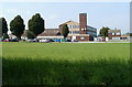
Willows High School, Cardiff
Located on the NE side of Willows Avenue, viewed from Seawall Road.
The school has about 900 pupils, from the Splott, Adamsdown and Tremorfa areas of Cardiff.
Image: © Jaggery
Taken: 3 Sep 2010
0.17 miles
3
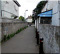
Path to Mona Place, Tremorfa, Cardiff
From Tweedsmuir Road.
Image: © Jaggery
Taken: 16 Jun 2017
0.18 miles
4
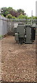
Inside Tremorfa electricity substation, Cardiff
A glimpse through the Tweedsmuir Road perimeter railings
of this http://www.geograph.org.uk/photo/5420870 Western Power Distribution electricity substation.
Image: © Jaggery
Taken: 8 Jun 2017
0.18 miles
5
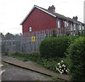
Tremorfa electricity substation, Cardiff
The Western Power Distribution electricity substation is in a fenced enclosure set back from Tweedsmuir Road in the Tremorfa area of Cardiff. Its identifier is TREMORFA S/S 51-1200.
Image: © Jaggery
Taken: 8 Jun 2017
0.18 miles
6
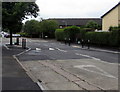
Tweedsmuir Road speed bump, Tremorfa, Cardiff
Painted white triangles on the road surface draw attention to the bump and the narrower road.
Image: © Jaggery
Taken: 8 Jun 2017
0.19 miles
7
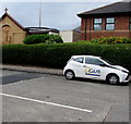
Q Care car, Tweedsmuir Road, Tremorfa, Cardiff
The car is parked near Saint Philip's Church. http://www.geograph.org.uk/photo/5442254
Q Care's head office is in Abergavenny http://www.geograph.org.uk/photo/3842917
Image: © Jaggery
Taken: 8 Jun 2017
0.19 miles
8
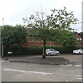
Tree on a triangular island at a Tremorfa junction, Cardiff
On the Cairnmuir Road side of the Tweedsmuir Road junction.
Image: © Jaggery
Taken: 8 Jun 2017
0.19 miles
9
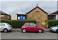
Saint Philip's Church, Tremorfa, Cardiff
Viewed across Tweedsmuir Road. Saint Philip's Church is in the Church
in Wales Conventional District of Tremorfa in the Diocese of Llandaff.
Tremorfa Community Hall http://www.geograph.org.uk/photo/5442250 is on the left.
Image: © Jaggery
Taken: 8 Jun 2017
0.20 miles
10
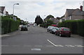
Mervyn Road, Tremorfa, Cardiff
East along Mervyn Road from Muirton Road towards Meredith Road, Madoc Road and Mercia Road.
Image: © Jaggery
Taken: 16 Jun 2017
0.20 miles