1
Ordnance Survey Cut Mark
This OS cut mark can be found on No118 Moorland Road. It marks a point 10.004m above mean sea level.
Image: © Adrian Dust
Taken: 16 Mar 2018
0.03 miles
2
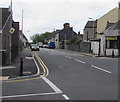
South along Moorland Road, Splott, Cardiff
From the corner of North Park Road. Tackle-Mart http://www.geograph.org.uk/photo/5433193 is on the right.
Image: © Jaggery
Taken: 16 Jun 2017
0.05 miles
3
Habershon Street, Splott, Cardiff
Viewed from the corner of Moorland Road and North Park Road. Tackle-Mart http://www.geograph.org.uk/photo/5433193 is on the left.
Image: © Jaggery
Taken: 16 Jun 2017
0.05 miles
4
Ordnance Survey Cut Mark
This OS cut mark can be found on No113 Haberston Street. It marks a point 10.351m above mean sea level.
Image: © Adrian Dust
Taken: 16 Mar 2018
0.05 miles
5
Habershon Street, Splott, Cardiff
Viewed from the corner of Moorland Road and North Park Road.
The car is parked near the corner of Cameron Street.
Image: © Jaggery
Taken: 16 Jun 2017
0.09 miles
6
Tackle-Mart on a Splott corner, Cardiff
Selling fishing tackle & bait and outdoor sporting goods, Steve's Tackle-Mart
is at 182 Habershon Street on the corner of Moorland Road.
Image: © Jaggery
Taken: 16 Jun 2017
0.10 miles
7
West side of Splott Park, Cardiff
The trees and bushes are between the park and railway lines.
Image: © Jaggery
Taken: 16 Jun 2017
0.10 miles
8
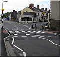
Zebra crossing on a Moorland Road hump, Splott, Cardiff
Painted white triangles draw attention to the hump across Moorland Road.
Tackle-Mart http://www.geograph.org.uk/photo/5433193 is in the background.
Image: © Jaggery
Taken: 16 Jun 2017
0.11 miles
9
Railway bridges, Muirton Rd, Cardiff
Image: © John Lord
Taken: 23 Feb 2012
0.12 miles
10
North Park Road railway bridges, Cardiff
Two railway tracks are on the bridge in the foreground.
Tracks on the bridge in the background were removed many years ago.
Image: © Jaggery
Taken: 16 Jun 2017
0.12 miles


