1
Ordnance Survey Cut Mark
This OS cut mark can be found on No150 Carlisle Street. It marks a point 10.741m above mean sea level.
Image: © Adrian Dust
Taken: 16 Mar 2018
0.05 miles
2
Habershon Street, Splott, Cardiff
Viewed from the corner of Moorland Road and North Park Road. Tackle-Mart http://www.geograph.org.uk/photo/5433193 is on the left.
Image: © Jaggery
Taken: 16 Jun 2017
0.05 miles
3
Ordnance Survey Cut Mark
This OS cut mark can be found on No113 Haberston Street. It marks a point 10.351m above mean sea level.
Image: © Adrian Dust
Taken: 16 Mar 2018
0.06 miles
4
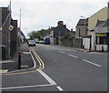
Habershon Street, Splott, Cardiff
Viewed from the corner of Moorland Road and North Park Road.
The car is parked near the corner of Cameron Street.
Image: © Jaggery
Taken: 16 Jun 2017
0.07 miles
5
Tackle-Mart on a Splott corner, Cardiff
Selling fishing tackle & bait and outdoor sporting goods, Steve's Tackle-Mart
is at 182 Habershon Street on the corner of Moorland Road.
Image: © Jaggery
Taken: 16 Jun 2017
0.09 miles
6
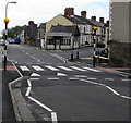
Zebra crossing on a Moorland Road hump, Splott, Cardiff
Painted white triangles draw attention to the hump across Moorland Road.
Tackle-Mart http://www.geograph.org.uk/photo/5433193 is in the background.
Image: © Jaggery
Taken: 16 Jun 2017
0.10 miles
7
South along Moorland Road, Splott, Cardiff
From the corner of North Park Road. Tackle-Mart http://www.geograph.org.uk/photo/5433193 is on the right.
Image: © Jaggery
Taken: 16 Jun 2017
0.10 miles
8
Wilson Street houses, Splott, Cardiff
Viewed from Moorland Road.
Image: © Jaggery
Taken: 16 Jun 2017
0.10 miles
9
Cameron Street, Cardiff
Taken from its junction with Railway Street. The Roman Catholic Church of St Alban's On the Moors has scaffolding on its pyramidal roof. "Built 1911 by F R Bates ... Free perpendicular style ... Listed as relatively rare large-scale resourcefully-composed example of Roman Catholic church" http://ishare.cardiff.gov.uk/Projects/Cadw/CardiffListedBuildings/18291.pdf . The white building is the presbytery.
Image: © Derek Harper
Taken: 16 Jun 2018
0.10 miles
10
Ordnance Survey Cut Mark
This OS cut mark can be found on No118 Moorland Road. It marks a point 10.004m above mean sea level.
Image: © Adrian Dust
Taken: 16 Mar 2018
0.11 miles


