1
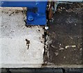
Ordnance Survey Rivet
This OS rivet can be found on the wall of No35 Moorland Road. It marks a point 10.348m above mean sea level.
Image: © Adrian Dust
Taken: 16 Mar 2018
0.01 miles
2
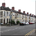
Moorland Road houses, Splott, Cardiff
Row of houses south of the Vale Road junction on the left.
Image: © Jaggery
Taken: 16 Jun 2017
0.02 miles
3
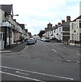
Wilson Street, Splott
The terrace housing in this road is typical of this area. Looking towards the north-west.
Image: © Linda Bailey
Taken: 3 Apr 2006
0.03 miles
4
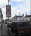
Warning signs facing Moorland Road, Splott, Cardiff
The signs nearest the camera refer to this http://www.geograph.org.uk/photo/5433218 zebra crossing on a hump.
The other sign has a stereotypical depiction of elderly people (Henoed in Welsh).
Image: © Jaggery
Taken: 16 Jun 2017
0.03 miles
5
Wilson Street houses, Splott, Cardiff
Viewed from Moorland Road.
Image: © Jaggery
Taken: 16 Jun 2017
0.03 miles
6
The Salvation Army, Crichton House, Dowlais Court, Cardiff
Viewed across Vale Road from the corner of Horwood Close.
Image: © Jaggery
Taken: 16 Jun 2017
0.04 miles
7
Carlisle Street, Splott, Cardiff
Looking to the SW along Carlisle Street from Moorland Road. Ema Balti is on the left. http://www.geograph.org.uk/photo/5433021
Image: © Jaggery
Taken: 16 Jun 2017
0.04 miles
8
Ordnance Survey Cut Mark
This almost hidden OS cut mark can be found on No209 Carlisle Street. It marks a point 10.473m above mean sea level.
Image: © Adrian Dust
Taken: 16 Mar 2018
0.05 miles
9
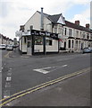
Ema Balti, Splott, Cardiff
Indian takeaway at 222 Carlisle Street on the corner of Moorland Road.
Image: © Jaggery
Taken: 16 Jun 2017
0.05 miles
10
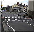
Zebra crossing on a Moorland Road hump, Splott, Cardiff
Painted white triangles draw attention to the hump across Moorland Road.
Tackle-Mart http://www.geograph.org.uk/photo/5433193 is in the background.
Image: © Jaggery
Taken: 16 Jun 2017
0.05 miles


