
IMAGES TAKEN NEAR TO
Pennsylvania, CARDIFF, CF23 9LT
Introduction
This page details the photographs taken nearby to Pennsylvania, CF23 9LT by members of the Geograph project.
The Geograph project started in 2005 with the aim of publishing, organising and preserving representative images for every square kilometre of Great Britain, Ireland and the Isle of Man.

There are currently over 7.5m images from over14,400 individuals and you can help contribute to the project by visiting https://www.geograph.org.uk
Image Map
Images are licensed for reuse under creativecommons.org/licenses/by-sa/2.0
Notes
- Clicking on the map will re-center to the selected point.
- The higher the marker number, the further away the image location is from the centre of the postcode.
Image Listing (19 Images Found)
Images are licensed for reuse under creativecommons.org/licenses/by-sa/2.0
Image
Details
Distance
1

New Penn, Llanedeyrn, Cardiff
Suburban pub on the corner of Brynfedw and Circle Road West.
The pub's name is derived from the area of housing on its south side named Pennsylvania.
Image: © Jaggery
Taken: 10 Aug 2013
0.10 miles
2
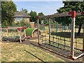
Children's playground
School playground at Llanedeyrn.
Image: © Alan Hughes
Taken: 19 Jul 2018
0.11 miles
3

Glenwood Church Centre, Cardiff
Viewed from the corner of Circle Way West and Glenwood.
Image: © Jaggery
Taken: 10 Aug 2013
0.15 miles
4
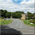
Road to Wern Goch West and Glenwood, Cardiff
Viewed across Circle Way West in the NE suburbs of Cardiff. The bridge carries the road over a footpath.
Image: © Jaggery
Taken: 10 Aug 2013
0.17 miles
5
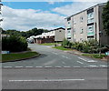
Brynfedw, Cardiff
Viewed across Llanedeyrn Drive. This is the south side of Brynfedw, an area of about 300 houses and flats.
Image: © Jaggery
Taken: 10 Aug 2013
0.18 miles
6
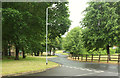
Glenwood
The road seen from Wern Goch West.
Image: © Derek Harper
Taken: 16 Jun 2018
0.18 miles
8
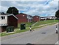
Pair of dark green telecoms boxes, Llanedeyrn, Cardiff
Viewed across Llanedeyrn Drive in the NE suburbs of Cardiff.
Image: © Jaggery
Taken: 10 Aug 2013
0.19 miles
9
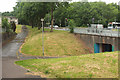
Paths and subway, Llanedeyrn
By the junction of Circle Way (right) with Glyn Coed Road.
Image: © Derek Harper
Taken: 16 Jun 2018
0.20 miles
10
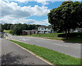
Llanedeyrn Drive bus stop and shelter
This side of the road is for buses towards the city centre.
Image: © Jaggery
Taken: 10 Aug 2013
0.20 miles