
IMAGES TAKEN NEAR TO
Wyncliffe Gardens, CARDIFF, CF23 7FB
Introduction
This page details the photographs taken nearby to Wyncliffe Gardens, CF23 7FB by members of the Geograph project.
The Geograph project started in 2005 with the aim of publishing, organising and preserving representative images for every square kilometre of Great Britain, Ireland and the Isle of Man.

There are currently over 7.5m images from over14,400 individuals and you can help contribute to the project by visiting https://www.geograph.org.uk
Image Map
Images are licensed for reuse under creativecommons.org/licenses/by-sa/2.0
Notes
- Clicking on the map will re-center to the selected point.
- The higher the marker number, the further away the image location is from the centre of the postcode.
Image Listing (16 Images Found)
Images are licensed for reuse under creativecommons.org/licenses/by-sa/2.0
Image
Details
Distance
1
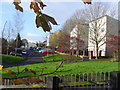
Pant Glas
Residential street, late 20th century apartment blocks, located off Pentwyn Road in northern Cardiff.
Image: © Colin Smith
Taken: 15 Nov 2009
0.09 miles
2

Lidl, Pentwyn Road
Lidl supermarket in Llanedeyrn, Cardiff.
Image: © Alan Hughes
Taken: 19 Jul 2018
0.18 miles
3
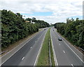
Eastern Avenue skirts the edge of Pentwyn, Cardiff
A view NNE along the A48 Eastern Avenue from an overbridge. The top of Pentwyn Service Station http://www.geograph.org.uk/photo/3592482 can be seen above trees centre left.
Image: © Jaggery
Taken: 10 Aug 2013
0.19 miles
4
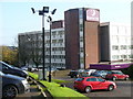
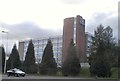
Premier Inn, Cardiff North
This hotel, formerly a "Holiday Inn", is close to the busy A48. It gets much of its weekday trade from business folk and weekend trade from sports fans.
Image: © Colin Smith
Taken: 15 Nov 2009
0.19 miles
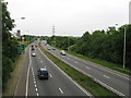
6
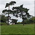
Straight conifer and bent conifer, Pentwyn, Cardiff
Located north of Pentwyn Road near this path crossroads. http://www.geograph.org.uk/photo/3592501
Image: © Jaggery
Taken: 10 Aug 2013
0.20 miles
8
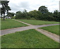
Path crossroads, Pentwyn, Cardiff
The paths are set back from the north side of Pentwyn Road, near Pentwyn Service Station. http://www.geograph.org.uk/photo/3592482
Image: © Jaggery
Taken: 10 Aug 2013
0.20 miles
9
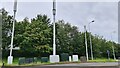
Mobile Phone Masts
Including 5G gives great data speeds (outdoors at least).
Image: © Steve Barnes
Taken: 11 Aug 2021
0.21 miles
10
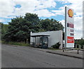
Bus stop and shelter near Pentwyn Service Station, Cardiff
Viewed across Pentwyn Road. The Shell sign is at the edge of the service station. http://www.geograph.org.uk/photo/3592482
Image: © Jaggery
Taken: 10 Aug 2013
0.22 miles