IMAGES TAKEN NEAR TO
Springwood, CARDIFF, CF23 6UF

Introduction

This page details the photographs taken nearby to Springwood, CF23 6UF by members of the Geograph project.

The Geograph project started in 2005 with the aim of publishing, organising and preserving representative images for every square kilometre of Great Britain, Ireland and the Isle of Man.

There are currently over 7.5m images from over14,400 individuals and you can help contribute to the project by visiting https://www.geograph.org.uk

Image Map


Images are licensed for reuse under creativecommons.org/licenses/by-sa/2.0
Notes
  • Clicking on the map will re-center to the selected point.
  • The higher the marker number, the further away the image location is from the centre of the postcode.

Image Listing (11 Images Found)

Images are licensed for reuse under creativecommons.org/licenses/by-sa/2.0
Image
Details
Distance
1
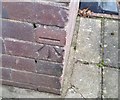
Ordnance Survey Cut Mark
This OS cut mark can be found on No188 Cyncoed Road. It marks a point 62.795m above mean sea level.
Image: © Adrian Dust Taken: 19 Nov 2017
0.10 miles
2
The Haining, Cyncoed, Cardiff
House on the east side of Cyncoed Road.
Image: © Jaggery Taken: 11 Oct 2010
0.14 miles
3
Dominant tree, Cyncoed Road, Cardiff
A tree planted near the pavement edge of a house garden on the east side on Cyncoed Road now extends out across half the width of the roadway, and almost to the edge of the house.
Image: © Jaggery Taken: 11 Oct 2010
0.14 miles
4
Ordnance Survey Cut Mark
This OS cut mark can be found on No177 Cyncoed Road. It marks a point 67.638m above mean sea level.
Image: © Adrian Dust Taken: 19 Nov 2017
0.15 miles
5
Children's playground
School playground at Llanedeyrn.
Image: © Alan Hughes Taken: 19 Jul 2018
0.16 miles
6
Winnipeg Drive, Cyncoed
Climbing, with houses on the left and Swan Mear Wood on the right.
Image: © Derek Harper Taken: 16 Jun 2018
0.18 miles
7
Four detached houses, Cyncoed Road, Cardiff
The houses occupy the east side of Cyncoed Road between Brynderwen Close and Caer Cady Close.
Image: © Jaggery Taken: 11 Oct 2010
0.18 miles
8
Cardiff : corner of Cyncoed Road and Caer Cady Close, Cyncoed
On the left, Caer Cady Close heads away from Cyncoed Road.
Image: © Jaggery Taken: 11 Oct 2010
0.18 miles
9
Winnipeg Drive, Cyncoed
Looking the other way along the road shown in Image], from further north. Swan Mear Wood is therefore on the left.
Image: © Derek Harper Taken: 16 Jun 2018
0.18 miles
10
Path, Springwood
Linking Werngoch Road to Circle Way West.
Image: © Derek Harper Taken: 16 Jun 2018
0.24 miles