IMAGES TAKEN NEAR TO
Ogwen Drive, CARDIFF, CF23 6LL

Introduction

This page details the photographs taken nearby to Ogwen Drive, CF23 6LL by members of the Geograph project.

The Geograph project started in 2005 with the aim of publishing, organising and preserving representative images for every square kilometre of Great Britain, Ireland and the Isle of Man.

There are currently over 7.5m images from over14,400 individuals and you can help contribute to the project by visiting https://www.geograph.org.uk

Image Map


Images are licensed for reuse under creativecommons.org/licenses/by-sa/2.0
Notes
  • Clicking on the map will re-center to the selected point.
  • The higher the marker number, the further away the image location is from the centre of the postcode.

Image Listing (9 Images Found)

Images are licensed for reuse under creativecommons.org/licenses/by-sa/2.0
Image
Details
Distance
1
Junction of Ogwen Drive & Claerwen Drive, Cardiff
Image: © John Lord Taken: 16 Jan 2010
0.14 miles
2
Rannoch Drive, Cardiff
The piles of green plastic sacks are awaiting the recycling collection
Image: © John Lord Taken: 16 Jan 2010
0.14 miles
3
All Saints' Church, Cyncoed, Cardiff
Church in Wales church located on the east side of Cyncoed Road, between Cyncoed Avenue and Werngoch Road. Despite being less than 5 kilometres from Llandaff Cathedral, the church is in the diocese of Monmouth, not Llandaff.
Image: © Jaggery Taken: 11 Oct 2010
0.17 miles
4
Cardiff : corner of Cyncoed Road and Cyncoed Avenue
Signs indicate a 7.5 tonne weight limit (except for access) along Cyncoed Avenue.
Image: © Jaggery Taken: 11 Oct 2010
0.18 miles
5
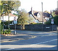
Cyn-Coed Road, Cyncoed
Approaching the junction with Rannoch Drive /Werngoch Road. The tall deodar cedar on the right is subject to a tree preservation order, as is the copper beech on the left.
Image: © Derek Harper Taken: 16 Jun 2018
0.18 miles
6
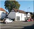
The Old Coach House, Cyncoed, Cardiff
Modernised house on Cyncoed Road, between St Ederyn's Road and Hollybush Road. An indicator of its older origin than neighbouring houses is that it is located at the edge of the pavement, whereas surrounding houses are set back several metres.
Image: © Jaggery Taken: 11 Oct 2010
0.20 miles
7
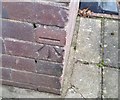
Ordnance Survey Cut Mark
This OS cut mark can be found on No177 Cyncoed Road. It marks a point 67.638m above mean sea level.
Image: © Adrian Dust Taken: 19 Nov 2017
0.24 miles
8
Southern corner of Cyncoed Road and Cyncoed Place, Cardiff
The house is opposite Cotswold Court. http://www.geograph.org.uk/photo/2114722
Image: © Jaggery Taken: 11 Oct 2010
0.24 miles
9
All Saints Church, Cyncoed, Cardiff
Image: © John Lord Taken: 16 Jan 2010
0.25 miles