1
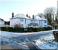
Cwm Gwynlais, Tongwynlais
Houses near the eastern edge of Tongwynlais, on a street named Cwm Gwynlais, at the corner of Pwllhelyg (on the left). Cwm Gwynlais connects with Merthyr Road, a few metres behind the camera.
Image: © Jaggery
Taken: 29 Nov 2010
0.02 miles
2
A470 north from M4 junction 32
Image: © John Firth
Taken: 5 Sep 2012
0.07 miles
3
Bus stops, eastern edge of Tongwynlais
The bus stops are on Merthyr Road (A4054). Although Tongwynlais has been absorbed into the City of Cardiff, Cardiff Bus does not have a service to the village. Most buses through Tongwynlais are provided by Stagecoach.
Image: © Jaggery
Taken: 29 Nov 2010
0.07 miles
4
Start of cycle route, Merthyr Road, Tongwynlais
At the eastern edge of Tongwynlais, a footpath and cycle route heads away SSE from Merthyr Road.
The sign on the right has an arrow pointing along the route and shows Pantmawr and Whitchurch.
Image: © Jaggery
Taken: 29 Nov 2010
0.07 miles
5
Castle View, Tongwynlais
Houses at the western end of Castle View, on the corner of Pantgwynlais (a residential road).
Image: © Jaggery
Taken: 29 Nov 2010
0.08 miles
6
Path heads SE away from Iron Bridge Road
Viewed from the southern edge of the A470 bridge. http://www.geograph.org.uk/photo/2183076 A path heads SE away from Iron Bridge Road. http://www.geograph.org.uk/photo/2183199
Image: © Jaggery
Taken: 29 Nov 2010
0.10 miles
7
The view west from the Coryton Interchange, Cardiff
The Coryton Interchange is a major group of junctions near the northern edge of Cardiff. It includes junction 32 of the M4, the A4054 and the A470. This view, from a footbridge http://www.geograph.org.uk/photo/2181859 is looking west along a slip road from the A470. The A470 passes across the bridge above another slip road.
Image: © Jaggery
Taken: 29 Nov 2010
0.10 miles
8
West side of Greenmeadow Drive, Tongwynlais
Viewed from the corner of Pantgwynlais (a residential road). In the background is Greenmeadow Wood.
Image: © Jaggery
Taken: 29 Nov 2010
0.10 miles
9
Cycle route footbridge near Tongwynlais
A footbridge carries a combined footpath and cycle route across the road connecting the A470 and A4054.
Image: © Jaggery
Taken: 29 Nov 2010
0.10 miles
10
NW edge of the Coryton Interchange, Cardiff
The Coryton Interchange is a major group of junctions near the northern edge of Cardiff. It includes junction 32 of the M4, the A4054 and the A470. This view, from a footbridge, http://www.geograph.org.uk/photo/2181859 shows a junction of A4054 and A470 slip roads. The bridge carries the A470, here named Northern Avenue.
Image: © Jaggery
Taken: 29 Nov 2010
0.10 miles


