
IMAGES TAKEN NEAR TO
Woodruff Way, CARDIFF, CF14 9FP
Introduction
This page details the photographs taken nearby to Woodruff Way, CF14 9FP by members of the Geograph project.
The Geograph project started in 2005 with the aim of publishing, organising and preserving representative images for every square kilometre of Great Britain, Ireland and the Isle of Man.

There are currently over 7.5m images from over14,400 individuals and you can help contribute to the project by visiting https://www.geograph.org.uk
Image Map
Images are licensed for reuse under creativecommons.org/licenses/by-sa/2.0
Notes
- Clicking on the map will re-center to the selected point.
- The higher the marker number, the further away the image location is from the centre of the postcode.
Image Listing (31 Images Found)
Images are licensed for reuse under creativecommons.org/licenses/by-sa/2.0
Image
Details
Distance
1
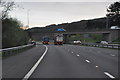
Cardiff : The M4 Motorway
The M4 Motorway heading through the Cardiff area.
Image: © Lewis Clarke
Taken: 10 Apr 2014
0.09 miles
2

Thornhill Road bridge across M4, looking east
Image: © Colin Pyle
Taken: 21 Mar 2011
0.10 miles
3
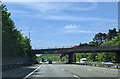
On the M4 westbound, about to go under the A469
Image: © Rob Purvis
Taken: 21 May 2023
0.11 miles
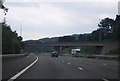
7
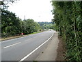
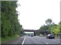
Start of National Speed Limit, Thornhill Road, Cardiff
As Thornhill Road approaches the bridge over the M4 motorway, the 40mph speed limit changes to the National Speed Limit. This is the northern edge of the City of Cardiff - its boundary with Caerphilly County Borough is a short distance ahead.
Image: © Jaggery
Taken: 12 Aug 2010
0.12 miles
8
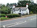
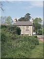
Rural northern Cardiff
Although within the City of Cardiff, the northern section of Thornhill Road passes through an area that is more rural than urban. This cottage on the west side of the road has no near neighbours.
Image: © Jaggery
Taken: 12 Aug 2010
0.13 miles
9
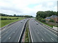
M4 motorway heading east, Thornhill, Cardiff
Viewed from Thornhill Road (A469).
Image: © Jaggery
Taken: 12 Aug 2010
0.14 miles
10
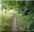
Separated pavement, Thornhill Road, Cardiff
North of the bridge over the M4 motorway, http://www.geograph.org.uk/photo/2008977 the pavement on the eastern side of Thornhill Road is separated from the roadway by about two metres of greenery, and follows a slightly lower course.
For the pedestrian, this is of course much better than having to walk in the roadway, but there is one minor drawback. The pavement is somewhat overgrown, with stinging nettles or brambles here and there growing across the pavement.
Image: © Jaggery
Taken: 12 Aug 2010
0.14 miles