IMAGES TAKEN NEAR TO
Whiteacre Close, CARDIFF, CF14 9DG

Introduction

This page details the photographs taken nearby to Whiteacre Close, CF14 9DG by members of the Geograph project.

The Geograph project started in 2005 with the aim of publishing, organising and preserving representative images for every square kilometre of Great Britain, Ireland and the Isle of Man.

There are currently over 7.5m images from over14,400 individuals and you can help contribute to the project by visiting https://www.geograph.org.uk

Image Map


Images are licensed for reuse under creativecommons.org/licenses/by-sa/2.0
Notes
  • Clicking on the map will re-center to the selected point.
  • The higher the marker number, the further away the image location is from the centre of the postcode.

Image Listing (9 Images Found)

Images are licensed for reuse under creativecommons.org/licenses/by-sa/2.0
Image
Details
Distance
1
Excalibur Drive, Thornhill
Image: © Kev Griffin Taken: 22 Apr 2007
0.03 miles
2
Cheriton Drive
Image: © Kev Griffin Taken: 22 Apr 2007
0.04 miles
3
Oakridge, Thornhill
Image: © Kev Griffin Taken: 22 Apr 2007
0.06 miles
4
Treeline between Excaliber Drive and Railway
Image: © Kev Griffin Taken: 13 Jan 2010
0.15 miles
5
Heol Hir, Thornhill
Image: © Kev Griffin Taken: 22 Apr 2007
0.16 miles
6
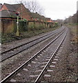
Railway south of Lisvane & Thornhill railway station, Cardiff
Looking south from the station along the Rhymney Line past signal CF2857. Next station ahead is Llanishen on the route to Cardiff Central.
Image: © Jaggery Taken: 21 Dec 2017
0.24 miles
7
Track replacement work underway near Llanishen
Image: © Gareth James Taken: 29 Oct 2017
0.24 miles
8
Rail-Head Treatment Train near Llanishen
Class 66 locomotive No. 66183 leads the water-jetting rail-head treatment train towards Llanishen after a visit to the Rhymney Valley. Classmate No. 66174 is on the rear.
Image: © Gareth James Taken: 17 Nov 2021
0.24 miles
9
Thornhill Sainsbury's, Cardiff
Image: © Kev Griffin Taken: 22 Apr 2007
0.25 miles