
IMAGES TAKEN NEAR TO
Glas-y-Pant, CARDIFF, CF14 7DB
Introduction
This page details the photographs taken nearby to Glas-y-Pant, CF14 7DB by members of the Geograph project.
The Geograph project started in 2005 with the aim of publishing, organising and preserving representative images for every square kilometre of Great Britain, Ireland and the Isle of Man.

There are currently over 7.5m images from over14,400 individuals and you can help contribute to the project by visiting https://www.geograph.org.uk
Image Map
Images are licensed for reuse under creativecommons.org/licenses/by-sa/2.0
Notes
- Clicking on the map will re-center to the selected point.
- The higher the marker number, the further away the image location is from the centre of the postcode.
Image Listing (102 Images Found)
Images are licensed for reuse under creativecommons.org/licenses/by-sa/2.0
Image
Details
Distance
1
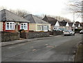
Heol Pant y Rhyn, Cardiff
Houses on the east side of Heol Pant y Rhyn, viewed from the Pantmawr Road end.
Image: © Jaggery
Taken: 19 Feb 2010
0.03 miles
2
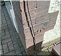
Ordnance Survey Cut Mark
This OS cut mark can be found on No70 Pantmawr Road. It marks a point 44.531m above mean sea level.
Image: © Adrian Dust
Taken: 26 Feb 2024
0.11 miles
3
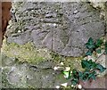
Ordnance Survey Cut Mark
This OS cut mark can be found on the overgrown building on Whitchurch Golf Course. It marks a point 43.788m above mean sea level.
Image: © Adrian Dust
Taken: 26 Feb 2024
0.11 miles
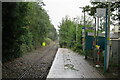
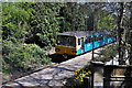
6
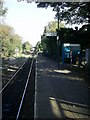
Coryton Station, Cardiff
Coryton Station, Cardiff, looking east.
Image: © Martyn Harries
Taken: 28 Oct 2008
0.12 miles
7
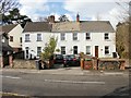
Three cottages, Pantmawr Road, Coryton, Cardiff
From left to right are Ivy Cottage, Rose Cottage and Holly Cottage.
Image: © Jaggery
Taken: 19 Feb 2010
0.12 miles
9
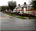
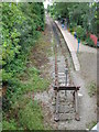
Houses and trees, Pantmawr Road, Cardiff
Viewed across the A4054.
Image: © Jaggery
Taken: 7 Oct 2019
0.13 miles
10

Coryton Station
A Transport for Wales service awaits departure from the branch line terminus at Coryton to Penarth. This line was originally built to transport coal from the Rhondda Valley, breaking the monopoly of the Taff Vale Railway (TVR). Although it opened in 1909, with a passenger service starting in 1911, the original purpose was never fulfilled due mainly to a legal battle with the TVR. Passenger trains only ran as far as Rhydyfelin, just short of Treforest, and they were cut back to Coryton in 1931. So the line became a purely suburban link serving the developing areas in north Cardiff. It was listed for closure in the 1963 'Beeching' report but somewhat surprisingly survived that threat, later becoming part of the South Wales Metro network which has included electrification.
Image: © Stephen McKay
Taken: 24 Mar 2026
0.13 miles