IMAGES TAKEN NEAR TO
Heol Pant Y Rhyn, CARDIFF, CF14 7DA
Introduction
This page details the photographs taken nearby to Heol Pant Y Rhyn, CF14 7DA by members of the Geograph project.
The Geograph project started in 2005 with the aim of publishing, organising and preserving representative images for every square kilometre of Great Britain, Ireland and the Isle of Man.

There are currently over 7.5m images from over14,400 individuals and you can help contribute to the project by visiting https://www.geograph.org.uk
Image Map
Images are licensed for reuse under creativecommons.org/licenses/by-sa/2.0
Notes
- Clicking on the map will re-center to the selected point.
- The higher the marker number, the further away the image location is from the centre of the postcode.
Image Listing (92 Images Found)
Images are licensed for reuse under creativecommons.org/licenses/by-sa/2.0
Image
Details
Distance
1
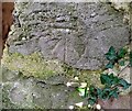
Ordnance Survey Cut Mark
This OS cut mark can be found on the overgrown building on Whitchurch Golf Course. It marks a point 43.788m above mean sea level.
Image: © Adrian Dust
Taken: 26 Feb 2024
0.06 miles
2
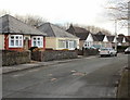
Heol Pant y Rhyn, Cardiff
Houses on the east side of Heol Pant y Rhyn, viewed from the Pantmawr Road end.
Image: © Jaggery
Taken: 19 Feb 2010
0.08 miles
3
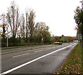
NW along Northern Avenue, Cardiff
Looking to the northwest along the A470 Northern Avenue in the Whitchurch area of Cardiff.
Image: © Jaggery
Taken: 6 Nov 2019
0.11 miles
4

Green suburbia
The line of trees above the rooftops flanks Northern Avenue, with the A470 heading out of Cardiff from right to left. Towards the far left can be seen a notch in the landscape indicating the Taff Vale, with Castell Coch just visible on the westward facing slope.
Image: © Alan Hughes
Taken: 8 May 2025
0.14 miles
5
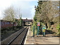
The view west from Whitchurch railway station, Cardiff
The view from the end of the platform looking towards the Northern Avenue (A470)
bridge. Beyond that is the end of the line at Coryton. http://www.geograph.org.uk/photo/1715623
Image: © Jaggery
Taken: 19 Feb 2010
0.15 miles
6
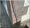
Ordnance Survey Cut Mark
This OS cut mark can be found on No70 Pantmawr Road. It marks a point 44.531m above mean sea level.
Image: © Adrian Dust
Taken: 26 Feb 2024
0.15 miles
8
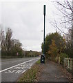
Northern Avenue telecoms mast and cabinets, Cardiff
Alongside a bus lane on the northeast side of the A470 Northern Avenue.
Image: © Jaggery
Taken: 6 Nov 2019
0.16 miles
9
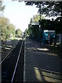
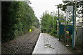
Coryton Station, Cardiff
Coryton Station, Cardiff, looking east.
Image: © Martyn Harries
Taken: 28 Oct 2008
0.16 miles