1
Red brick and white paint - Whitchurch
These buildings, appearing to be houses, are associated with the nearby hospital complex. Outwardly impressive to look at they show signs of 'occupied dereliction'.
Image: © Mick Lobb
Taken: 9 Apr 2010
0.01 miles
2
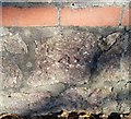
Ordnance Survey Cut Mark
This OS cut mark can be found on the wall of No52 Park Road. It marks a point 38.161m above mean sea level.
Image: © Adrian Dust
Taken: 18 Nov 2018
0.02 miles
3
Park Road (A4054) - Whitchurch
Image: © Mick Lobb
Taken: 9 Apr 2010
0.04 miles
4
Park Road (A4054) - Whitchurch
The section of road leading north-west out of Cardiff to the M4 .
Image: © Mick Lobb
Taken: 9 Apr 2010
0.05 miles
5
Whitchurch Village Practice, Cardiff
Located on Park Road (A4054), close to Whitchurch Hospital and Velindre Hospital.
Image: © Jaggery
Taken: 19 Feb 2010
0.07 miles
6
Children's Playground
Children's playground in Whitchurch.
Image: © Alan Hughes
Taken: 26 Dec 2016
0.07 miles
7
Bobath Centre, Whitchurch, Cardiff
Bobath Children's Therapy Centre Wales, 19 Park Road, Whitchurch.
Bobath is a national charity helping children with cerebral palsy.
Image: © Jaggery
Taken: 19 Feb 2010
0.08 miles
8
Velindre Hospital - Whitchurch
Image: © Mick Lobb
Taken: 15 Apr 2010
0.09 miles
9
Whitchurch Library Park, Cardiff
This ground was acquired by the Parish Council in 1899.
Image: © Robin Drayton
Taken: 8 May 2017
0.09 miles
10
Children's play area and park ,Whitchurch, Cardiff
A popular play area and park viewed near Whitchurch library after overnight snow. Velindre Cancer Centre can be seen in the distance beyond the snow covered trees.
Image: © Martyn Harries
Taken: 13 Jan 2010
0.09 miles


